Marblehead in Ottawa County, Ohio — The American Midwest (Great Lakes)
First Battle Site
1812
| — | Ohio Historical Marker | — |
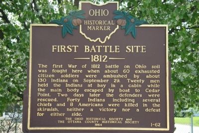
Photographed by Dale K. Benington, May 9, 2009
1. First Battle Site Marker
Erected 1964 by The Ohio Historical Society and The Ottawa County Historical Society. (Marker Number 1-62.)
Topics and series. This historical marker is listed in these topic lists: Indigenous Peoples and Communities • Landmarks • Military • War of 1812. In addition, it is included in the Ohio Historical Society / The Ohio History Connection series list. A significant historical month for this entry is September 1865.
Location. 41° 30.862′ N, 82° 44.633′ W. Marker is in Marblehead, Ohio, in Ottawa County. It is on East Bay Shore Road just west of Seneca Trail, on the right when traveling east. This historical marker is located on the south side of the Marblehead peninsula, on the north side of the
this page online

Regionally, this marker is on the Lake Erie Shore and in the Toledo Metropolitan Area. It is also in the American Midwest and in the Corn Belt. Globally, it is in North America, on the Great Lakes, in the Western Hemisphere, in the Western World, and in the Anglosphere. Historically, it finds itself in what was once the Viceroyalty of New France, the Haudenosaunee (Iroquois) Confederacy, the territory of the Mississippian Culture, and the Northwest Territory.
Other nearby markers. At least 8 other markers are within walking distance of this marker: Call to Duty Salute (within shouting distance of this marker); In Memory of Mason, Simonds & Mingus (within shouting distance of this marker); The Keeper's House (about 500 feet away, measured in a direct line); Home of Benajah Walcott (about 500 feet away); a different marker also named The Keeper’s House (about 600 feet away); Wolcott Cemetery (approx. 0.3 miles away); a different marker
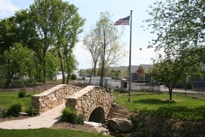
Photographed by Dale K. Benington, May 9, 2009
2. First Battle Site Memorial
Just south of the historical marker is a memorial to those who fought and those who died in the battle.
More about this marker. There are several other related historical markers and memorials in the immediate area of this marker.
Related marker. Click here for another marker that is related to this marker. To better understand the relationship, study each marker in the order shown.
Credits. This page was last revised on June 16, 2016. It was originally submitted on May 14, 2009, by Dale K. Benington of Toledo, Ohio. This page has been viewed 3,357 times since then and 145 times this year. Last updated on September 20, 2010, by Jamie Abel of Westerville, Ohio. Photos: 1, 2. submitted on May 14, 2009, by Dale K. Benington of Toledo, Ohio. • Kevin W. was the editor who published this page.
