Waverly in Sussex County, Virginia — The American South (Mid-Atlantic)
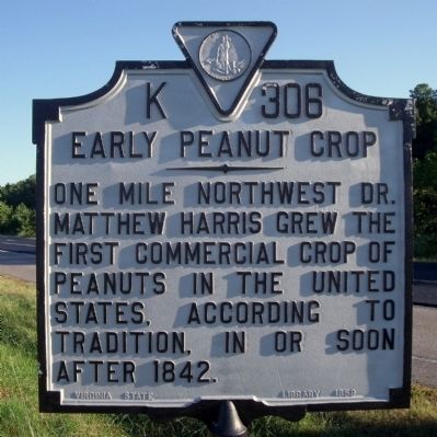
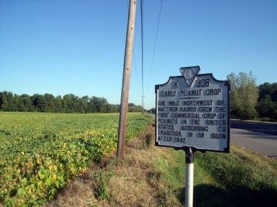
Early Peanut Crop
Erected 1959 by Virginia State library. (Marker Number K-306.)
Topics and series. This historical marker is listed in this topic list: Agriculture. In addition, it is included in the Virginia Department of Historic Resources (DHR) series list. A significant historical year for this entry is 1842.
Location. 37° 0.26′ N, 77° 2.669′ W. Marker is in Waverly, Virginia, in Sussex County. Marker is on South County Drive (U.S. 460) near George Town Road (Virginia Route 615), on the right when traveling west. Touch for map. Marker is in this post office area: Waverly VA 23890, United States of America. Touch for directions.
Other nearby markers. At least 8 other markers are within 5 miles of this marker, measured as the crow flies. Ellis Preaching House (approx. 1.3 miles away); Miles B. Carpenter (approx. 3.6 miles away); Coppahaunk Springs (approx. 3.6 miles away); World War I Monument (approx. 3.6 miles away); World War II - Korea - Vietnam Memorial (approx. 3.6 miles away); Roadside Commerce (approx. 3.7 miles away); Wakefield Fountain Corner (approx. 3.8 miles away); Colonel Michael Blow (approx. 4.8 miles away). Touch for a list and map of all markers in Waverly.
Credits. This page was last revised on November 14, 2021. It was originally submitted on September 20, 2010, by Bernard Fisher of Richmond, Virginia. This page has been viewed 1,024 times since then and 49 times this year. Photos: 1, 2. submitted on September 20, 2010, by Bernard Fisher of Richmond, Virginia.

