Milledgeville in Baldwin County, Georgia — The American South (South Atlantic)
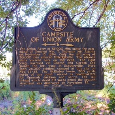
Campsite of Union Army
<------<<<<
Erected 1962 by Georgia Historical Commission. (Marker Number 005-14.)
Topics and series. This historical marker is listed in this topic list: War, US Civil. In addition, it is included in the Georgia Historical Society, and the Sherman’s March to the Sea series lists. A significant historical month for this entry is November 1881.
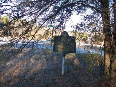
Location. 33° 5.118′ N, 83° 12.407′ W. Marker is in Milledgeville, Georgia, in Baldwin County. Marker is at the intersection of Georgia Route 22/24 and Old River Bridge Road, on the right when traveling east on State Route 22/24. The marker is in heavy brush, and can be very difficult to see. Touch for map. Marker is in this post office area: Milledgeville GA 31061, United States of America. Touch for directions.
Other nearby markers. At least 8 other markers are within 2 miles of this marker, measured as the crow flies. The Rock Landing (approx. 0.2 miles away); Old Fort Fidius (approx. 0.2 miles away); Alexis de Tocqueville (approx. 1.1 miles away); State House Square (approx. 1.1 miles away); Site of Fort Defiance (approx. 1.1 miles away); Old State Capitol (approx. 1.1 miles away); Milledgeville Confederate Monument (approx. 1.1 miles away); Troup-Clark Political Feud (approx. 1.1 miles away). Touch for a list and map of all markers in Milledgeville.
Credits. This page was last revised on June 16, 2016. It was originally submitted on September 21, 2010, by David Seibert of Sandy Springs, Georgia. This page has been viewed 2,192 times since then and 45 times this year. Photos: 1, 2. submitted on September 21, 2010, by David Seibert of Sandy Springs, Georgia. 3. submitted on January 27, 2011, by Michael Dover of Ellerslie, Georgia. • Craig Swain was the editor who published this page.


