Carrollton in Isle of Wight County, Virginia — The American South (Mid-Atlantic)
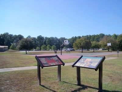
Missile Magazine and Launch Operations
Range: 25-30 miles Speed: Mach 3 (1,679 mph) Altitude: 70,000 feet
Length: 34 feet 10 inches with booster Missile only: 21 feet
Weight: 2,455 lbs. with booster Missile only: 1,000 lbs.
Diameter: 12 inches Wingspan: 4 feet 6 inches
Warhead: Three high-explosive fragmentation charges mounted in the nose, center and aft sections
Guidance: Command by electronic computer and radar
Fuels: Booster — solid propellant, Missile — red fuming nitric acid
Missile System Contractors
Airframe: Douglas Aircraft Company, Santa Monica, California
Propulsion: Hercules Powder Company, Radford Arsenal, Virginia
Sustainer: Bell Aircraft Company, Buffalo, New York
Guidance: Bell Telephone Laboratories, New York, New York
(sidebar)
Directions to Jones Creek Site from Carrollton Nike Park:
Turn left onto Nike Park Road, right onto Titus Creek Drive, left onto Smiths Neck Road, left onto Boundary Road. Jones Creek Site is at the end of Boundary Road.
Topics. This historical marker is listed in this topic list: War, Cold.
Location. 36° 57.717′ N, 76° 33.757′ W. Marker is in Carrollton, Virginia, in Isle of Wight County . Marker can be reached from Nike Park Road (Virginia Route 669) 0.1 miles south of Carrollton Court. This marker is located in Carrollton Nike Park. Touch for map. Marker is at or near this postal address: 13036 Nike Park Road, Carrollton VA 23314, United States of America. Touch for directions.
Other nearby markers. At least 8 other markers are within 3 miles of this marker, measured as the crow flies. People and Places, circa 1957 at N-75L (here, next to this marker); 1954 Nike-Ajax Missile Site N-75L (about 500 feet away, measured in a direct line); Nike-Ajax Missile Radar Control Site N-75C (approx. 0.9 miles away); Josiah Parker (approx. 1.1 miles away); Saint Luke's Church (approx. 2 miles away); Historic St. Luke's Church (approx. 2.1 miles away); St. Luke’s Church (approx. 2.1 miles away); Benn’s Church (approx. 2.2 miles away). Touch for a list and map of all markers in Carrollton.
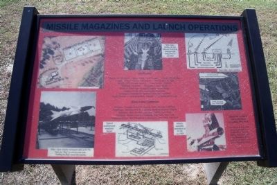
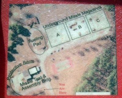
More about this marker. On the upper left is an aerial photograph of the launch site.
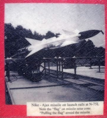
On the lower left is a photograph of a launch ready missile with the caption, “Nike–Ajax missile on launch rails at N-75L Note the “flag” on missile cone. “Pulling the flag” armed the missile.”
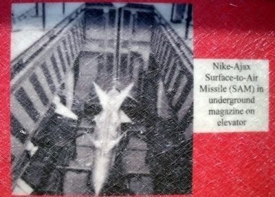
On the top center is a photograph of an underground missile magazine with the caption, “Nike–Ajax Surface-to-Air Missile (SAM) in underground magazine on elevator”.
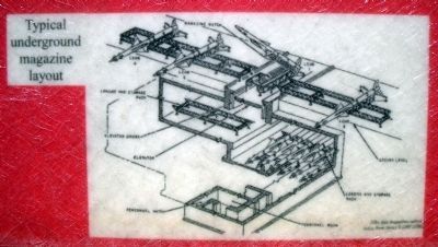
On the bottom center is a diagram of a “Typical underground magazine layout”.
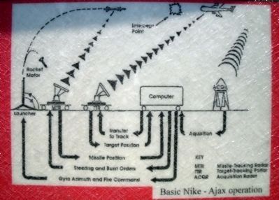
On the upper right is a diagram of “Basic Nike–Ajax operations”.
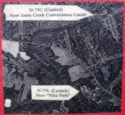
On the middle right is an aerial photograph of the control and launch sites labeled, “N-75C (Control) Now Jones Creek Convenience Center” and “N-75L (Launch) Now “Nike Park””.
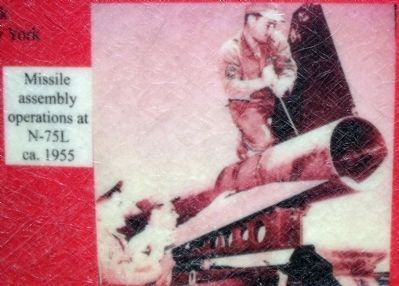
On the lower right is a photograph of “Missile assembly operations at N75L ca. 1955”.
Also see . . .
1. Nike-Ajax Missile Site N-75. Smithfield & Isle of Wight Convention and Visitors Bureau (Submitted on September 21, 2010, by Bernard Fisher of Richmond, Virginia.)
2. Nike-Ajax Missile Site N-75. Isle of Wight County (Submitted on September 21, 2010, by Bernard Fisher of Richmond, Virginia.)
3. Nike Historical Society. (Submitted on September 21, 2010, by Bernard Fisher of Richmond, Virginia.)
Credits. This page was last revised on November 9, 2021. It was originally submitted on September 21, 2010, by Bernard Fisher of Richmond, Virginia. This page has been viewed 1,257 times since then and 12 times this year. Photos: 1, 2, 3, 4, 5, 6, 7, 8, 9. submitted on September 21, 2010, by Bernard Fisher of Richmond, Virginia.
