Marker Logo HMdb.org THE HISTORICAL
MARKER DATABASE
“Bite-Size Bits of Local, National, and Global History”
Near Boulder Junction in Vilas County, Wisconsin — The American Midwest (Great Lakes)
 

Devils Lake Vista Subcontinental Divide


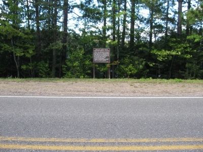
Devils Lake Vista Subcontinental Divide Marker image. Click for full size.
Photographed By Keith L, September 13, 2010
1. Devils Lake Vista Subcontinental Divide Marker
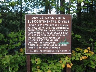
Inscription. Devils Lake, seen here, is a glacial pot-hole on top of a sub-continental divide, waters on its northeast side flow north via the Ontonagon River to Lake Superior and thence east to the Atlantic, while waters on its south side flow via High Lake and the Manitowish, Flambeau, Chippewa and Mississippi Rivers to the Gulf of Mexico.

Vilas County Forestry Recreation and Land Dept.

 
Erected by Vilas County Forestry Recreation and Land Department.
 
Topics. This historical marker is listed in this topic list: Waterways & Vessels.
 
Location. 46° 10.271′ N, 89° 31.443′ W. Marker is near Boulder Junction, Wisconsin, in Vilas County. Marker is on County Road B east of Rainbo Lodge Lane, on the left when traveling east. Marker is along the north shoulder of the road. Touch for map. Marker is at or near this postal address: 8650 County Road B, Land O Lakes WI 54540, United States of America. Touch for directions.
 
Other nearby markers. At least 3 other markers are within 13 miles of this marker, measured as the crow flies. First Forest Patrol Flight (approx. 9˝ miles away); Forest Restoration (approx. 10.6 miles away); Snowmobile (approx. 12.8 miles away).
 
Paid Advertisement
Click on the ad for more information.
Please report objectionable advertising to the Editor.
Click or scan to see
this page online
Devils Lake Vista Subcontinental Divide Marker image. Click for full size.
Photographed By Keith L, September 13, 2010
2. Devils Lake Vista Subcontinental Divide Marker
 
 
Credits. This page was last revised on October 24, 2020. It was originally submitted on September 22, 2010, by Keith L of Wisconsin Rapids, Wisconsin. This page has been viewed 1,426 times since then and 44 times this year. Photos:   1, 2. submitted on September 22, 2010, by Keith L of Wisconsin Rapids, Wisconsin.
Share this page.  
Share on Tumblr
m=36047

CeraNet Cloud Computing sponsors the Historical Marker Database.
This website earns income from purchases you make after using our links to Amazon.com. We appreciate your support.
Paid Advertisement
Apr. 17, 2024