Smithfield in Isle of Wight County, Virginia — The American South (Mid-Atlantic)
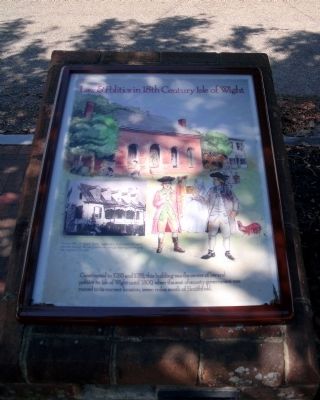
Law & Politics in 18th Century Isle of Wight
Inscription.
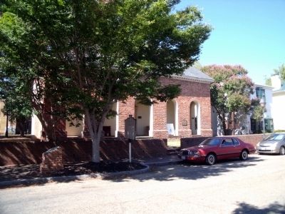
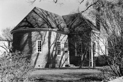
Constructed in 1750 and 1751, this building was the center of law and politics in Isle of Wight County until 1800, when the seat of county government was moved to its current location, seven miles south of Smithfield.
Topics. This historical marker is listed in these topic lists: Colonial Era • Government & Politics. A significant historical year for this entry is 1750.
Location. 36° 58.905′ N, 76° 37.918′ W. Marker is in Smithfield, Virginia, in Isle of Wight County. Marker is at the intersection of Main Street (U.S. 258) and South Mason Street, on the right when traveling east on Main Street. Touch for map. Marker is in this post office area: Smithfield VA 23430, United States of America. Touch for directions.
Other nearby markers. At least 8 other markers are within walking distance of this marker. Old Isle of Wight Courthouse (a few steps from this marker); Ivy Hill Cemetery (within shouting distance of this marker); Bricks in the Crosswalk (within shouting distance of this marker); Atkinson Storehouse (about 500 feet away, measured in a direct line); Isle of Wight County War Memorial (about 600 feet away); The Todd House & the First Smithfield Ham (about 700 feet away); Founding Site of Smithfield Packing Company (approx. 0.2 miles away); Joseph W. Luter, III (approx. 0.4 miles away). Touch for a list and map of all markers in Smithfield.
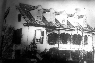
More about this marker . The background watercolor depicts 18th century activities around the Courthouse. On the left is a photograph of the house that removed during restoration of the Courthouse. It carries the caption, "Around 1812, Dr. Robert Butler ingeniously constructed his home over and around the old courthouse, without altering or enlarging the original brick walls."
Also see . . . Old Isle of Wight Courthouse. National Register of Historic Places (Submitted on September 22, 2010.)
Credits. This page was last revised on November 9, 2021. It was originally submitted on September 22, 2010, by Bernard Fisher of Richmond, Virginia. This page has been viewed 799 times since then and 15 times this year. Photos: 1, 2, 3, 4. submitted on September 22, 2010, by Bernard Fisher of Richmond, Virginia.


