Speers Ferry in Scott County, Virginia — The American South (Mid-Atlantic)
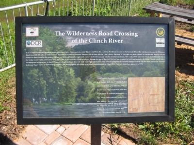
The Wilderness Road Crossing of the Clinch River
Inscription.
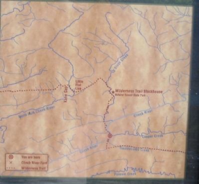
In 1775 Daniel Boone and a group of axmen, following a Native American trade route, blazed a trail from the Anderson Blockhouse to a site on the Kentucky River. This trail, later to become the Wilderness Road, traversed 200 miles of wilderness and encountered a number of natural barriers. One of these was the Clinch River. The gorge to your right has been widened by considerable blasting and rock removal to make room for the modern highway and railroad, but in the eighteenth century it afforded passage only for Troublesome Creek. This creek, which enters the Clinch about fifty yards east of the bridge to your right, got its name from the trouble it gave travelers trying to follow it through the gap to the river. The ford was on a shelf of rock that lies under the bridge. Though usually safe, it was dangerous in high water. In May 1779 a party of militia almost drowned while crossing the river here. They were escorting British Governor Henry Hamilton, who had been captured at Vincennes by George Rogers Clark, to Williamsburg, Virginia. The photograph on this exhibit is an artist's conception of the Clinch River Ford as it might have appeared in 1779.
"29th. Crossed the north branch of Clinch river, forded stock creek 6 times, forded Clinch river with great difficulty, some of the men were near being drownd, it fell sleet and hail with an exceeding sharp wind - a very small canoe took over some of us, after making a fire & getting well warmed we proceeded on our march thro' cane brakes, the ways crooked steep & miry"
From Hamilton's Diary, May 29, 1779
Erected by Virginia Department of Conservation & Recreation and Scott County Virginia.
Topics. This historical marker is listed in these topic lists: Roads & Vehicles • Settlements & Settlers • War, US Revolutionary. A significant historical month for this entry is May 1779.
Location. 36° 39.271′ N, 82° 44.81′ W. Marker is in Speers Ferry, Virginia, in Scott County. Marker is on Orby Cantrell Highway (U.S. 58), on the right when traveling north. Located at a pull off providing a view of the Clinch River and railroad bridges. Touch for map. Marker is in this post office area: Duffield VA 24244, United States of America. Touch for directions.
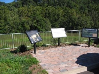
Other nearby markers. At least 8 other markers are within 9 miles of this marker, measured as the crow flies. Natural Tunnel: Railroading and Recreation (here, next to this marker); The Copper Creek Railroad Trestles (here, next to this marker); Speers Ferry (within shouting distance of this marker); Carter’s Fort (approx. 2.8 miles away); The Natural Tunnel Route (approx. 3.2 miles away); a different marker also named Carter’s Fort (approx. 4.6 miles away); Scott County / Lee County (approx. 8.1 miles away); Lee County / Scott County (approx. 8.4 miles away). Touch for a list and map of all markers in Speers Ferry.
Credits. This page was last revised on March 22, 2021. It was originally submitted on September 23, 2010, by Craig Swain of Leesburg, Virginia. This page has been viewed 1,486 times since then and 46 times this year. Photos: 1, 2, 3. submitted on September 23, 2010, by Craig Swain of Leesburg, Virginia.


