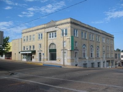
Poplar Bluff in Butler County, Missouri — The American Midwest (Upper Plains)
Poplar Bluff
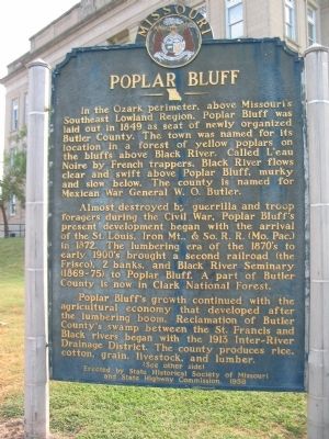
In the Ozark perimeter, above Missouri's Southeast Lowland Region, Poplar Bluff was laid out in 1849 as seat of newly organized Butler County. The town was named for its location in a forest of yellow poplars on the bluffs above Black River. Called L'eau Noire by French trappers, Black River flows clear and swift above Poplar Bluff, murky and slow below. The county is named for Mexican War General W.O. Butler.
Almost destroyed by guerrilla and troop foragers during the Civil War, Poplar Bluff's present development began with the arrival of the St. Louis, Iron Mt., & So. R.R. (Mo. Pac.) in 1872. The lumbering era of the 1870's to early 1900's brought a second railroad (the Frisco), 2 banks, and Black River Seminary (1869-75) to Poplar Bluff. A part of Butler County is now in Clark National Forest.
Poplar Bluff's growth continued with the agricultural economy that developed after the lumbering boom. Reclamation of Butler County's swamp between the St. Francis and Black rivers began with the 1913 Inter-River Drainage District. The county produces rice, cotton, grain, livestock, and lumber.
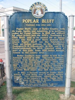
(Reverse):
Butler County's first settler is said to be Solomon Kittrell in 1819. The early pioneers, largely from Kentucky and Tennessee, were attracted by the plentiful water, wood, and game. Taxes were often paid in furs. About 1881, a number of German families formed a short-lived communal colony in the vicinity of Gillis Bluff where they laid out Carola.
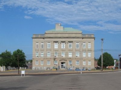
In 1927, a tornado struck in Poplar Bluff killing 87 and doing over 2 million dollars damage. The courthouse, rebuilt after the disaster, is the county's fourth. Poplar Bluff was the home of Dwight H. Brown, Missouri's Secretary of State, 1932-44.
Erected 1958 by State Historical Society of Missouri and State Highway Commission.
Topics and series. This historical marker is listed in these topic lists: Exploration • Government & Politics • Settlements & Settlers • War, US Civil. In addition, it is included in the Missouri, The State Historical Society of series list. A significant historical year for this entry is 1849.
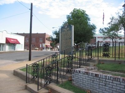
Location. 36° 45.379′ N, 90° 23.563′ W. Marker is in Poplar Bluff, Missouri, in Butler County. Marker is at the intersection of Main Street and Vine Street on Main Street. Located on the southwest corner of the County Courthouse. Touch for map. Marker is in this post office area: Poplar Bluff MO 63901, United States of America. Touch for directions.
Other nearby markers. At least 6 other markers are within walking distance of this marker. Pvt. Billie Gene Kanell (within shouting distance of this marker); a different marker also named Poplar Bluff (about 500 feet away, measured in a direct line); Historic Brick Streets (about 600 feet away); First Presbyterian Church USA (about 600 feet away); Poplar Bluff Historic Depot (approx. 0.2 miles away); Original Town Poplar Bluff (approx. 0.4 miles away).
Regarding Poplar Bluff. Clark National Forest, mentioned on the marker, was consolidated into Mark Twain National Forest in the 1970s.
Credits. This page was last revised on November 17, 2020. It was originally submitted on September 24, 2010, by Craig Swain of Leesburg, Virginia. This page has been viewed 2,308 times since then and 79 times this year. Photos: 1, 2, 3, 4, 5. submitted on September 24, 2010, by Craig Swain of Leesburg, Virginia.
