Rockport in Essex County, Massachusetts — The American Northeast (New England)
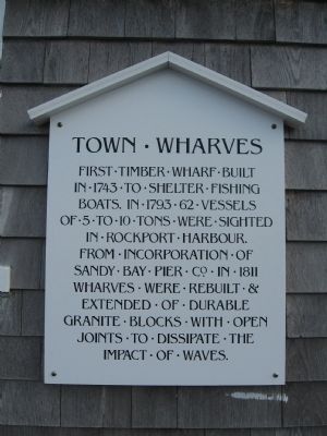
Town Wharves
Topics. This historical marker is listed in these topic lists: Colonial Era • Industry & Commerce • Waterways & Vessels. A significant historical year for this entry is 1743.
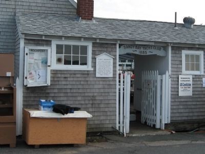
Location. 42° 39.52′ N, 70° 36.872′ W. Marker is in Rockport, Massachusetts, in Essex County. Marker can be reached from the intersection of Mt. Pleasant Street (Massachusetts Route 127A) and Broadway, on the right when traveling north. Located next to the entrance of the Sandy Bay Yacht Club at the end of Rockport's T-Wharf. Touch for map. Marker is in this post office area: Rockport MA 01966, United States of America. Touch for directions.
Other nearby markers. At least 8 other markers are within walking distance of this marker. Cannon from the U.S.S. Constitution (here, next to this marker); Rockport World War I & II Memorial (about 500 feet away, measured in a direct line); Harvey Park (about 600 feet away); Bear Skin Neck (about 600 feet away); Old Stone Fort (about 800 feet away); Straitsmouth Island (approx. 0.2 miles away); The First Settlers of Sandy Bay (approx. ¼ mile away); First Congregational Church of Rockport Steeple Rehabilitation (approx. ¼ mile away). Touch for a list and map of all markers in Rockport.
Also see . . . Sandy Bay Yacht Club. Club website homepage (Submitted on September 28, 2010, by Michael Herrick of Southbury, Connecticut.)
Credits. This page was last revised on April 27, 2021. It was originally submitted on September 28, 2010, by Michael Herrick of Southbury, Connecticut. This page has been viewed 659 times since then and 10 times this year. Photos: 1, 2. submitted on September 28, 2010, by Michael Herrick of Southbury, Connecticut.

