Near Osceola in Mississippi County, Arkansas — The American South (West South Central)
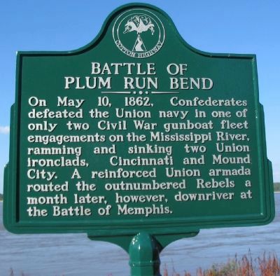
Battle of Plum Run Bend
On May 10, 1862, Confederates defeated the Union navy in one of only two Civil War gunboat fleet engagements on the Mississippi River, ramming and sinking two Union ironclads, Cincinnati and Mound City. A reinforced Union armada routed the outnumbered Rebels a month later, however, downriver at the Battle of Memphis.
Topics. This historical marker is listed in this topic list: War, US Civil. A significant historical month for this entry is May 1874.
Location. 35° 39.297′ N, 89° 55.517′ W. Marker is near Osceola, Arkansas, in Mississippi County. Marker is on State Highway 198 when traveling east. Located at the Sans Souci Landing parking lot. Touch for map. Marker is in this post office area: Osceola AR 72370, United States of America. Touch for directions.
Other nearby markers. At least 8 other markers are within 4 miles of this marker, measured as the crow flies. Fighting Near Osceola (a few steps from this marker); Osceola Hornets (a few steps from this marker); Mark Twain's Plum Point Landing & Overlook (within shouting distance of this marker); Sans Souci (within shouting distance of this marker); Mississippi River Levee (within shouting distance of this marker); Calvary Episcopal Church (approx. 4 miles away); Planters Bank Building (approx. 4.1 miles away); Bank of Osceola (approx. 4.1 miles away). Touch for a list and map of all markers in Osceola.
Also see . . .
1. Fort Pillow naval battle. Wikipedia entry (Submitted on August 20, 2021, by Larry Gertner of New York, New York.)
2. Battle of Plum Point Bend. Civil War Talk website entry (Submitted on August 20, 2021, by Larry Gertner of New York, New York.)

Photographed By Craig Swain, August 31, 2010
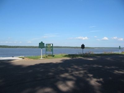
3. Mississippi River
Looking across the River from the landing. The river has made drastic course changes since the war. In 1862, the river made a sharp bend to the east, nearly at the current landing/overlook site. Much of the fighting near Plum Point occurred in that old river chute.

Photographed By Craig Swain, August 31, 2010
4. Down River to Fort Pillow
Confederates placed Fort Pillow on high bluffs to the south of Plum Point. The bluffs are just visible in this view in the distance to the right. A tow-barge works up stream in the "new" river course, cutting across Craighead Point. During the war, the river made a series of bends through the bottom land. Today the course is somewhat straighter.
Credits. This page was last revised on August 20, 2021. It was originally submitted on September 30, 2010, by Craig Swain of Leesburg, Virginia. This page has been viewed 2,590 times since then and 37 times this year. Photos: 1, 2, 3, 4. submitted on September 30, 2010, by Craig Swain of Leesburg, Virginia.

