Del Rio in Val Verde County, Texas — The American South (West South Central)
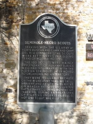
Seminole-Negro Scouts
Serving with the U. S. Army at Forts Duncan and Clark and Camp Del Rio (1870-1881), the Scouts were key figures in ridding Texas of hostile Indians.
The 100 Scouts were mainly descendants of runaway slaves who had intermarried with the Florida Seminoles, later moved to Oklahoma Indian Territory.
They were invaluable because of their uncanny trailing skill, bravery, and ability to survive on meager rations (including rattlesnakes) during months of tracking. During an 8-year span of fighting under Lt. J. L. Bullis, not one Scout was killed.
Erected 1968 by State Historical Survey Committee. (Marker Number 4639.)
Topics. This historical marker is listed in these topic lists: African Americans • Military • Native Americans • Wars, US Indian.
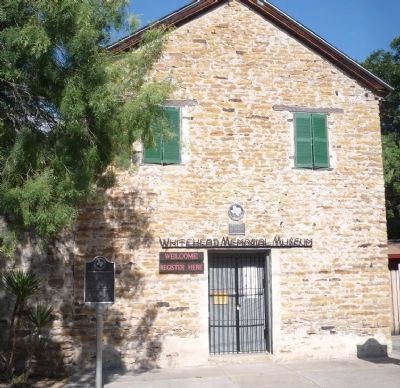
Location. 29° 21.078′ N, 100° 53.887′ W. Marker is in Del Rio, Texas, in Val Verde County. Marker is on S. Main Street south of E. Duke Street., on the left when traveling south. Marker is on the sidewalk in front of the Old Perry Building at the entrance to the Whitehead Memorial Museum. S. Main Street is one block west of Pecan Street and the museum is approximately one mile south of downtown Del Rio and West Garfield Street (U.S. Hwy. 277). Touch for map. Marker is at or near this postal address: 1308 S Main Street, Del Rio TX 78840, United States of America. Touch for directions.
Other nearby markers. At least 8 other markers are within walking distance of this marker. Old Perry Building (here, next to this marker); Roy Bean, C. S. A. (here, next to this marker); Taylor-Rivers House (about 800 feet away, measured in a direct line); The Cassinelli Gin House (approx. 0.2 miles away); Mason-Foster House (approx. ¼ mile away); Val Verde Winery (approx. 0.4 miles away); Brown Plaza (approx. 0.4 miles away); Canal System of Del Rio (approx. 0.4 miles away). Touch for a list and map of all markers in Del Rio.
Additional keywords. Black Indians; Whitehead Memorial Museum.
Credits. This page was last revised on November 17, 2021. It was originally submitted on August 28, 2010, by Richard E. Miller of Oxon Hill, Maryland. This page has been viewed 1,373 times since then and 41 times this year. Last updated on October 2, 2010, by Richard E. Miller of Oxon Hill, Maryland. Photos: 1, 2. submitted on August 28, 2010, by Richard E. Miller of Oxon Hill, Maryland. • Bill Pfingsten was the editor who published this page.

