Jacksonville in Calhoun County, Alabama — The American South (East South Central)
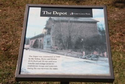
The Depot
Chief Ladiga Trail
Photographed by Tim & Renda Carr, October 2, 2010
1. The Depot Marker
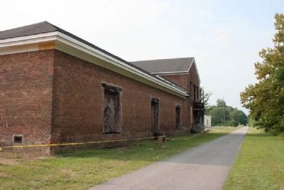
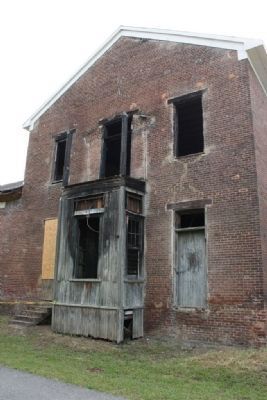
The Depot was constructed in 1860 by the Selma, Rome and Dalton (GA) Railroad. It was used as a transfer and storage point for Confederate troops and materials during the War Between the States.
Topics. This historical marker is listed in these topic lists: Railroads & Streetcars • War, US Civil. A significant historical year for this entry is 1860.
Location. 33° 49.084′ N, 85° 46.393′ W. Marker is in Jacksonville, Alabama, in Calhoun County. It can be reached from Mountain Street Northwest west of Woodward Avenue Northwest. Marker is located on the Chief Ladiga Trail next to the Old Jacksonville's Depot of the Selma, Rome and Dalton Railroad. Touch for map. Marker is in this post office area: Jacksonville AL 36265, United States of America. Touch for directions.

Regionally, this marker is in East Alabama. It is also in the American South and specifically in the Deep South. Globally, it is in North America, a Gulf of Mexico state, the Western Hemisphere, the Western World, and the Anglosphere. Historically, it finds itself in what was once the original Cherokee Nation, the territory of the Mississippian Culture,
this page online
Other nearby markers. At least 8 other markers are within walking distance of this marker: Chief Ladiga Trail - Jacksonville (a few steps from this marker); Jacksonville, Alabama (a few steps from this marker); Profile Cotton Mills Historic District (approx. 0.4 miles away); Profile Cotton Mill Historic District (approx. half a mile away); Presidents of Jacksonville State (approx. 0.6 miles away); Joseph William Burke (approx. 0.6 miles away); Jacksonville State University (approx. 0.6 miles away); "The Magnolias" (approx. 0.7 miles away). Touch for a list and map of all markers in Jacksonville.
Also see . . . Chief Ladiga Trail. Wikipedia entry (Submitted on September 18, 2024, by Larry Gertner of New York, New York.)
Photographed by Tim & Renda Carr, October 2, 2010
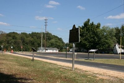
2. Chief Ladiga Trail - The Depot Marker (left)
Photographed by Tim & Renda Carr, October 2, 2010
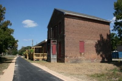
3. The Jacksonville Depot and the Chief Ladiga Trail
Photographed by Tim & Renda Carr, October 2, 2010
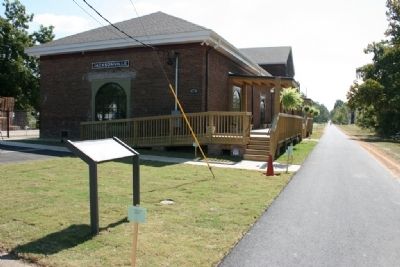
4. The Jacksonville Depot and the Chief Ladiga Trail
Photographed by Tim & Renda Carr
5. The Jacksonville Depot in 2008
Photographed by Tim & Renda Carr
6. The Jacksonville Depot in 2008
Credits. This page was last revised on September 18, 2024. It was originally submitted on October 3, 2010, by Timothy Carr of Birmingham, Alabama. This page has been viewed 2,663 times since then and 75 times this year. Photos: 1, 2, 3, 4, 5, 6. submitted on October 3, 2010, by Timothy Carr of Birmingham, Alabama. • Craig Swain was the editor who published this page.
