Jacksonville in Calhoun County, Alabama — The American South (East South Central)
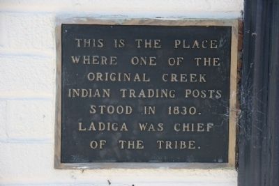
Site of Indian Trading Post
where one of the
original Creek
Indian Trading Posts
stood in 1830.
Ladiga was Chief
of the tribe.
Topics. This historical marker is listed in this topic list: Native Americans. A significant historical year for this entry is 1830.
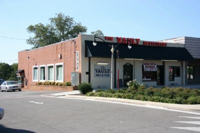
Location. 33° 48.808′ N, 85° 45.717′ W. Marker is in Jacksonville, Alabama, in Calhoun County. Marker is at the intersection of Public Square West (State Highway 21) and Ladiga Street Southwest, on the right when traveling south on Public Square West. Touch for map. Marker is at or near this postal address: 2 Public Square West, Jacksonville AL 36265, United States of America. Touch for directions.
Other nearby markers. At least 8 other markers are within walking distance of this marker. John Tyler Morgan (within shouting distance of this marker); 10th Alabama Volunteers (within shouting distance of this marker); Forney’s Corner (within shouting distance of this marker); Jacksonville (within shouting distance of this marker); John Horace Forney (within shouting distance of this marker); Downtown Jacksonville Historic District (within shouting distance of this marker); William Henry Forney (within shouting distance of this marker); The First National Bank of Jacksonville (about 300 feet away, measured in a direct line). Touch for a list and map of all markers in Jacksonville.
Credits. This page was last revised on June 16, 2016. It was originally submitted on October 3, 2010, by Timothy Carr of Birmingham, Alabama. This page has been viewed 1,632 times since then and 57 times this year. Photos: 1, 2, 3. submitted on October 3, 2010, by Timothy Carr of Birmingham, Alabama. • Bill Pfingsten was the editor who published this page.


