Montgomery in Montgomery County, Alabama — The American South (East South Central)
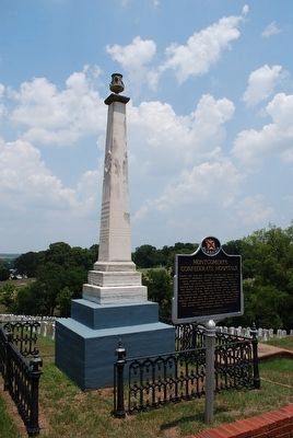
Civil War Medicine / Montgomery's Confederate Hospitals
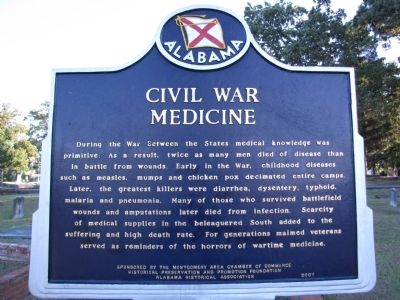
During the War Between the States medical knowledge was primitive. As a result, twice as many men died of disease than in battle from wounds. Early in the War, childhood diseases such as measles, mumps and chicken pox decimated entire camps. Later, the greatest killers were diarrhea, dysentery, typhoid, malaria and pneumonia. Many of those who survived battlefield wounds and amputations later died from infection. Scarcity of medical supplies in the beleaguered South added to the suffering and high death rate. For generations maimed veterans served as reminders of the horrors of wartime medicine.
Side B
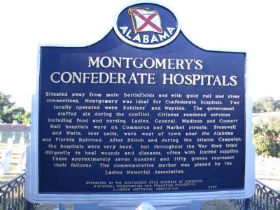
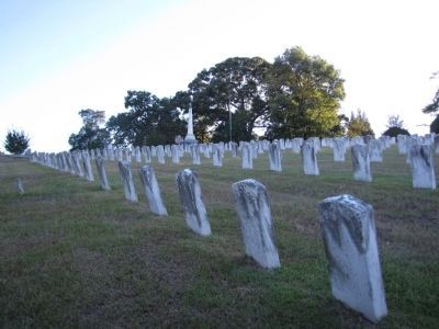
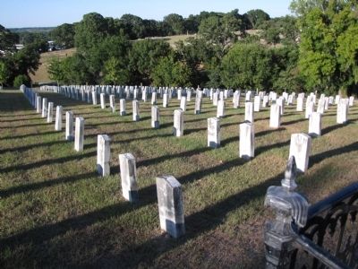
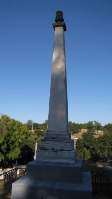
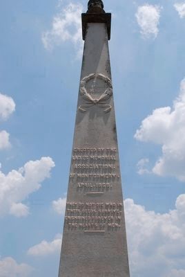
Situated away from main battlefields and with good rail and river connections, Montgomery was ideal for Confederate hospitals. Two locally operated were Soldiers' and Wayside. The government staffed six during the conflict. Citizens rendered services including food and nursing. Ladies, General, Madison and Concert Hall hospitals were on Commerce and Market streets; Stonewall and Watts, tent units, were west of town near the Alabama and Florida Railroad. After Shiloh and during the Atlanta Campaign, the hospitals were very busy, but throughout the War they tried diligently to heal wounds and diseases, often with limited supplies. These approximately seven hundred and fifty graves represent their failures. The commemorative marker was placed by the Ladies Memorial Association.
Erected 2007 by The Montgomery Area Chamber of Commerce Historical Preservation and Promotion Foundation Alabama Historical Association.
Topics and series. This historical marker is listed in this topic list: War, US Civil. In addition, it is included in the Alabama Historical Association series list.
Location. 32° 23.052′ N, 86° 17.792′ W. Marker is in Montgomery, Alabama, in Montgomery County. Marker can be reached from Columbus Street east of North Ripley Street, on the right when traveling west. Columbus Street is one-way going west in this area. It can be accessed from Upper Wetumpka Road or a small extension of North Jackson Street that goes through the police department parking lot. Marker is located in the Oakwood Cemetery. Touch for map. Marker is in this post office area: Montgomery AL 36104, United States of America. Touch for directions.
Other nearby markers. At least 8 other markers are within walking distance of this marker. Old Oakwood Cemetery (about 600 feet away, measured in a direct line); William C. Oates (about 700 feet away); Governor William Calvin Oates / Colonel W. C. Oates, CSA at Gettysburg (about 700 feet away); First Baptist Church (approx. 0.2 miles away); Burial Site of Royal Air Force Trainee Pilots (approx. 0.3 miles away); Royal Air Force Burial Ground (approx. 0.3 miles away); Militaires Francais Decedes Aux Etats-Unis Au Cours de la Guerre 1939-1945 (approx. 0.3 miles away); Alabama War Veterans Monument (approx. 0.4 miles away). Touch for a list and map of all markers in Montgomery.
Credits. This page was last revised on June 16, 2016. It was originally submitted on October 4, 2010, by Lee Hattabaugh of Capshaw, Alabama. This page has been viewed 2,532 times since then and 88 times this year. Photos: 1, 2, 3, 4. submitted on October 4, 2010, by Lee Hattabaugh of Capshaw, Alabama. 5. submitted on August 15, 2015, by Brandon Fletcher of Chattanooga, Tennessee. 6, 7. submitted on October 4, 2010, by Lee Hattabaugh of Capshaw, Alabama. 8. submitted on August 15, 2015, by Brandon Fletcher of Chattanooga, Tennessee. • Craig Swain was the editor who published this page.
