Pleasant Prairie in Kenosha County, Wisconsin — The American Midwest (Great Lakes)
The Name “Wisconsin”
Photographed by Paul F, September 28, 2010
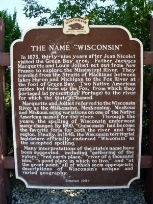
1. The Name "Wisconsin" Marker
Marquette and Jolliet referred to the Wisconsin River as the Miskonsing, Meskousing, Meskous and Miskous, using variations on one of the Native American names for the river. Through the years, the spelling of Wisconsin underwent many changes. By 1800, “Ouisconsin” had become the favorite form for both the river and the region. Finally, in 1845, the Wisconsin territorial legislature officially endorsed “Wisconsin” as the accepted spelling.
Many interpretations of the state’s name have been suggested, including “gathering of the waters,” “red earth place,” “river of a thousand isles,” “a good place in which to live,” and “at
this page online
Erected 1994 by State Historical Society of Wisconsin. (Marker Number 219.)
Topics and series. This historical marker is listed in these topic lists: Exploration • Indigenous Peoples and Communities • Notable Places • Settlements & Settlers. In addition, it is included in the Wisconsin Historical Society series list. A significant historical year for this entry is 1673.
Location. 42° 31.322′ N, 87° 56.973′ W. Marker is in Pleasant Prairie, Wisconsin, in Kenosha County. It is at the intersection of Interstate 94 and Wisconsin Highway 165 on Interstate 94. Rest Area-Tourist Info Center No. 26, westbound lane I-94, North of Illinois state line, Kenosha County. Touch for map. Marker is in this post office area: Pleasant Prairie WI 53158, United States of America. Touch for directions.

Regionally, this marker is in Southeast Wisconsin and in Greater Milwaukee. It is also in the American Midwest and in the Corn Belt. Globally, it is in North America, on the Great Lakes, in the Western Hemisphere, in the
Photographed by Paul F, September 28, 2010
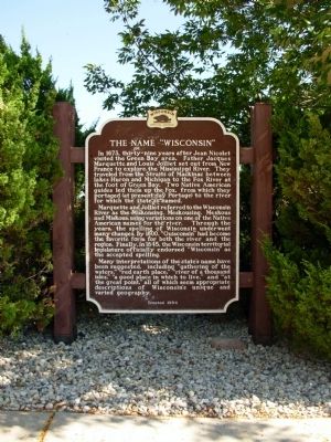
2. The Name "Wisconsin" Marker
Other nearby markers. At least 8 other markers are within 8 miles of this marker, measured as the crow flies: Cordelia A.P. Harvey (within shouting distance of this marker); Green Bay Ethnic Trail (approx. 3.1 miles away); Thirty-Second Division Memorial Highway (approx. 6.4 miles away); Auto Production in Kenosha (approx. 7.1 miles away); John Bullen (approx. 7.4 miles away); John McCaffery Burial Site (approx. 7.4 miles away); Kenosha Veterans Memorial (approx. 7½ miles away); Lovell G.A.R. Post 230 Civil War Memorial (approx. 7½ miles away). Touch for a list and map of all markers in Pleasant Prairie.
Also see . . . Wisconsin's Name - Where it came from and what it means. Wisconsin Historical Society website entry (Submitted on October 8, 2010, by Paul Fehrenbach of Richfield, Wisconsin.)
Additional keywords. State Names
Photographed by Paul F, September 28, 2010
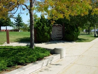
3. The Name "Wisconsin" Marker
Credits. This page was last revised on August 6, 2026. It was originally submitted on October 1, 2010, by Paul Fehrenbach of Richfield, Wisconsin. This page has been viewed 2,129 times since then and 99 times this year. Last updated on October 6, 2010, by Paul Fehrenbach of Richfield, Wisconsin. Photos: 1, 2, 3. submitted on October 1, 2010, by Paul Fehrenbach of Richfield, Wisconsin. • Bill Pfingsten was the editor who published this page.
