Franklin in Crawford County, Kansas — The American Midwest (Upper Plains)
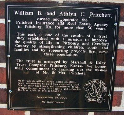
William B. and Athlyn C. Pritchett
Inscription.
owned and operated the Pritchett Insurance and Real Estate Agency in Pittsburg, Ks. for more than 50 years.
This park is one of the results of a trust they established with a mission to improve the quality of life in Pittsburg and Crawford County by strengthening children, youth, and families and by supporting projects that serve these populations.
The trust is managed by Marshall & Ilsley Trust Company, Pittsburg, Kansas. We honor their commitment to carrying out the wishes of Mr. & Mrs. Pritchett.
Many "angels without wings" spent countless hours volunteering to build this community park. Due to their hard work and commitment future generations can enjoy this facility and remember the true spirit of this community.
Dedicated May 28, 2006
the spirit remains
Erected 2006 by Town of Franklin, Concerned Citizens, and the Pritchetts.
Topics. This historical marker is listed in these topic lists: Industry & Commerce • Parks & Recreational Areas. A significant historical date for this entry is May 28, 2006.
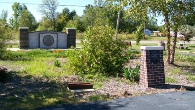
Location. 37° 31.364′ N, 94° 42.28′ W. Marker is in Franklin, Kansas, in Crawford County. Marker is on 5th Street near Broadway Street (Business U.S. 69), on the right when traveling east. Marker is in Franklin Community Park. Touch for map. Marker is in this post office area: Franklin KS 66735, United States of America. Touch for directions.
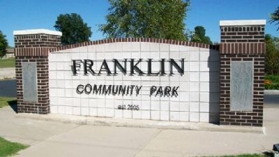
Other nearby markers. At least 8 other markers are within walking distance of this marker. Trolley / Street Car Rails (here, next to this marker); Franklin - Arma Sidewalk (a few steps from this marker); Franklin Grade School and Playground (a few steps from this marker); Franklin Community Park Sign (a few steps from this marker); Franklin School Bell (within shouting distance of this marker); Franklin Sidewalk (about 700 feet away, measured in a direct line); Church Bell from St. Philip Neri Catholic Church (about 700 feet away); Dragline Bucket (approx. 0.2 miles away). Touch for a list and map of all markers in Franklin.
Regarding William B. and Athlyn C. Pritchett. Franklin, Kansas, was decimated on May 4, 2003, when a tornado rolled through the heart of the town.
Also see . . . Franklin, Kansas. (Submitted on October 11, 2010, by William Fischer, Jr. of Scranton, Pennsylvania.)
Credits. This page was last revised on May 3, 2018. It was originally submitted on October 11, 2010, by William Fischer, Jr. of Scranton, Pennsylvania. This page has been viewed 695 times since then and 10 times this year. Photos: 1, 2. submitted on October 11, 2010, by William Fischer, Jr. of Scranton, Pennsylvania. 3. submitted on October 9, 2010, by William Fischer, Jr. of Scranton, Pennsylvania.


