
Olde Towne in Portsmouth, Virginia — The American South (Mid-Atlantic)
Emanuel A.M.E. Church
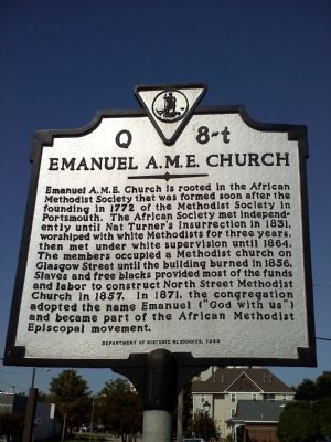
Photographed by James Thomson, October 11, 2010
1. Emanuel AME Church Marker
Emanuel A.M.E. Church is rooted in the African Methodist Society that was formed soon after the founding in 1772 of the Methodist Society in Portsmouth. The African Society met independently until Nat Turner's insurrection in 1831, worshiped with white Methodists for three years, then met under white supervision until 1864. The members occupied a Methodist church on Glasgow Street until the building burned in 1856. Slaves and free blacks provided most of the funds and labor to construct the North Street Methodist Church in 1857. In 1871, the congregation adopted the name Emanuel ("God with us") and become part of the African Methodist Episcopal movement.
Erected 1999 by Commonwealth of Virginia. (Marker Number Q 8-t.)
Topics and series. This historical marker is listed in these topic lists: Abolition & Underground RR • African Americans • Colonial Era • Religion & Religious Structures. In addition, it is included in the African Methodist Episcopal (AME) Church, and the Virginia Department of Historic Resources (DHR) series lists. A significant historical year for this entry is 1772.
Location. 36° 50.288′ N, 76° 18.322′ W.
this page online

Regionally, this marker is in Virginia’s Hampton Roads, specifically in Coastal Virginia, and in the Hampton Roads Metropolitan Area. It is also in the American South, specifically in the Upper South, in the Tidewater, and on the Eastern Seaboard. Globally, it is in the North Atlantic Region, North America, the Western Hemisphere, the Western World, and the Anglosphere. Historically, it finds itself in what was once the territory of the Mississippian Culture, one of the original Thirteen Colonies, one of the Confederate States of America, and the Antebellum South.
Other nearby markers. At least 8 other markers are within walking distance of this marker: Ruth Brown (here, next to this marker); Matilda Sissieretta Joyner Jones (here, next to this marker); Emanuel African Methodist Episcopal Church (within shouting
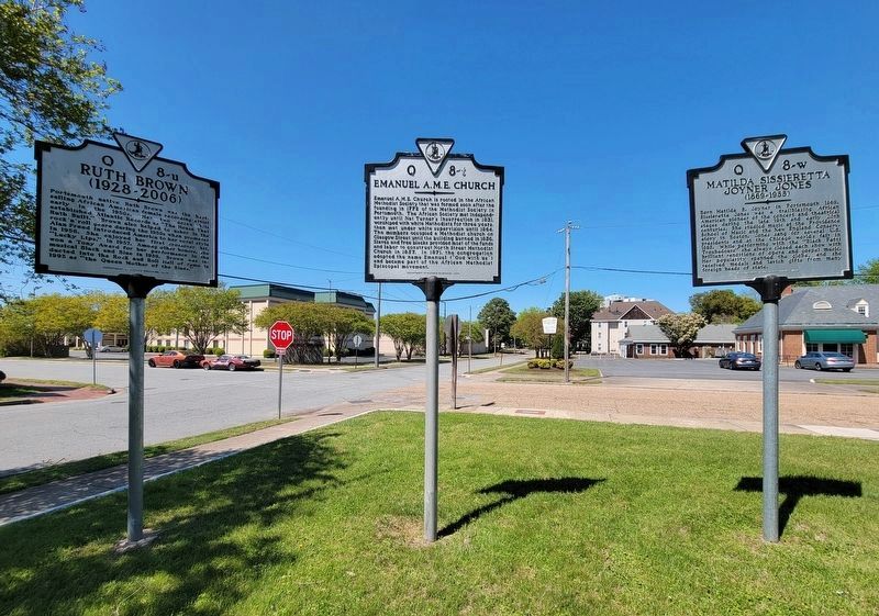
Photographed by C. Ryan Dodson, April 10, 2026
2. Emanuel A.M.E. Church Marker
Facing north
Regarding Emanuel A.M.E. Church. Said to be a stop in the Underground Railroad
Note the subtle difference in wording between the marker and the plaque on the building.
Also see . . .
1. Emanuel AME Church. Church website homepage (Submitted on September 22, 2022, by Larry Gertner of New York, New York.)
2. Nat Turner's Rebellion. PBS website entry (Submitted on October 18, 2010, by Bill Pfingsten of Bel Air, Maryland.)
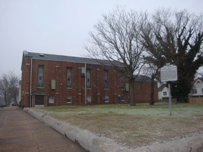
Photographed by Mike Wintermantel, February 12, 2014
3. Emanuel A.M.E. Church Marker
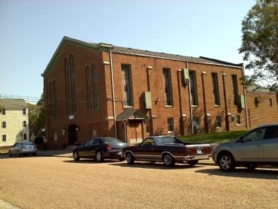
Photographed by James Thomson, October 11, 2010
4. Emanuel AME Church Marker
Credits. This page was last revised on April 13, 2026. It was originally submitted on October 11, 2010, by James Thomson of Chesapeake, United States. This page has been viewed 2,132 times since then and 66 times this year. Photos: 1. submitted on October 11, 2010, by James Thomson of Chesapeake, United States. 2. submitted on April 12, 2026, by C. Ryan Dodson of Danville, Virginia. 3. submitted on February 14, 2014, by Mike Wintermantel of Pittsburgh, Pennsylvania. 4. submitted on October 11, 2010, by James Thomson of Chesapeake, United States. • Bill Pfingsten was the editor who published this page.
