Olde Towne in Portsmouth, Virginia — The American South (Mid-Atlantic)
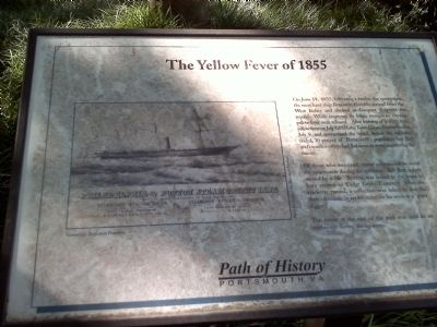
The Yellow Fever of 1855
Of those who remained, many volunteered to assist the community during the epidemic. Bob Butt, a slave owned by a Mr. Britton was leased to the town to bury victims in Cedar Grove Cemetery. After the epidemic passed, a collection was taken to buy the slave's freedom in appreciation for his work as a "grave digger".
The house at the end of the park was used as an orphanage during the epidemic.
Erected by Path of History, Portsmouth VA.
Topics. This historical marker is listed in these topic lists: African Americans • Charity & Public Work • Disasters • Science & Medicine. A significant historical month for this entry is June 1980.
Location. 36° 50.3′ N, 76° 18.133′ W. Marker is in Portsmouth, Virginia. It is in Olde Towne. Marker is at the intersection of North Street and Dinwiddie Street, on the right when traveling east on North Street. Marker is located in park. Touch for map. Marker is in this post office area: Portsmouth VA 23704, United States of America. Touch for directions.
Other nearby markers. At least 8 other markers are within walking distance of this marker. Watts House (here, next to this marker); Elks Lodge (about 400 feet away, measured in a direct line); Richard Dale, U.S.N. (about 500 feet away); St. John's Church (about 700 feet away); Fort Nelson (about 700 feet away); Olde Towne Portsmouth (about 700 feet away); Arnold's British Defenses, 1781 (about 700 feet away); Lincolnsville (about 700 feet away). Touch for a list and map of all markers in Portsmouth.
Also see . . . Yellow Fever in Norfolk and Portsmouth, Virginia - 1855. as reported in the Daily Dispatch of Richmond, Virginia. (Submitted on October 14, 2010, by James Thomson of Chesapeake, United States.)
Credits. This page was last revised on February 1, 2023. It was originally submitted on October 12, 2010, by James Thomson of Chesapeake, United States. This page has been viewed 1,535 times since then and 47 times this year. Photo 1. submitted on October 12, 2010, by James Thomson of Chesapeake, United States. • Bill Pfingsten was the editor who published this page.
