Sloansville in Schoharie County, New York — The American Northeast (Mid-Atlantic)
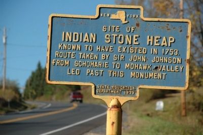
Indian Stone Heap
Indian Stone Heap
Known to have existed in 1753.
Route taken by Sir John Johnson
from Schoharie to Mohawk Valley
led past this monument
Erected 1939 by New York State Education Department.
Topics. This historical marker is listed in these topic lists: Native Americans • War, US Revolutionary. A significant historical year for this entry is 1753.
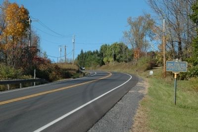
Location. 42° 45.685′ N, 74° 19.868′ W. Marker is in Sloansville, New York, in Schoharie County. Marker is on 162,, ¼ mile north of Route 20 (U.S. 20), on the right when traveling north. Touch for map. Marker is at or near this postal address: 1376 Route 162, Sloansville NY 12160, United States of America. Touch for directions.
Other nearby markers. At least 8 other markers are within 4 miles of this marker, measured as the crow flies. Sloansville (approx. 0.3 miles away); Site Of Encampment (approx. 1.1 miles away); Schoharie Junction (approx. 2.9 miles away); Early Militia Training (approx. 3.4 miles away); Central Bridge (approx. 3½ miles away); Daniel W. Jenkins (approx. 3½ miles away); Chocolate Jumbles (approx. 3.6 miles away); The Presbyterian Church Esperance, NY (approx. 3.6 miles away). Touch for a list and map of all markers in Sloansville.
Credits. This page was last revised on June 16, 2016. It was originally submitted on October 12, 2010, by Howard C. Ohlhous of Duanesburg, New York. This page has been viewed 1,431 times since then and 83 times this year. Photos: 1, 2, 3. submitted on October 12, 2010, by Howard C. Ohlhous of Duanesburg, New York. • Syd Whittle was the editor who published this page.


