Ruther Glen in Caroline County, Virginia — The American South (Mid-Atlantic)
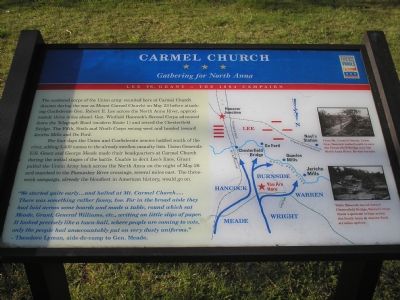
Carmel Church
Gathering for North Anna
— Lee vs. Grant - The 1864 Campaign —
The scattered corps of the Union army reunited here at Carmel Church (known during the war as Mount Carmel Church) on May 23 before attacking Confederate Gen. Robert E. Lee across the North Anna River, approximately three miles ahead. Gen. Winfield Hancock’s Second Corps advanced down the Telegraph Road (modern Route 1) and seized the Chesterfield Bridge. The Fifth, Sixth and Ninth Corps swung west and headed towards Jericho Mills and Ox Ford.
For four days the Union and Confederate armies battled south of the river, adding 3,400 names to the already swollen casualty lists. Union Generals U.S. Grant and George Meade made their headquarters at Carmel Church during the initial stages of the battle. Unable to dent Lee’s lines, Grant pulled the Union Army back across the North Anna on the night of May 26 and marched to the Pamunkey River crossings, several miles east. The three-week campaign, already the bloodiest in American history, would go on.
“We started quite early…and halted at Mt. Carmel Church…. There was something rather funny, too. For in the broad aisle they had laid across some boards and made a table, round which sat Meade, Grant, General Williams, etc., writing on little slips of paper. It looked precisely like a town-hall, where people are coming to vote, only the people had unaccountably put on very dusty uniforms.”
- Theodore Lyman, aide-de-camp to Gen. Meade.
[Captions:]
From Mt. Carmel Church, Union Gen. Hancock rushed south to save the Chesterfield Bridge over the North Anna River. He was too late.
While Hancock moved towards Chesterfield Bridge, Warren’s corps threw a pontoon bridge across the North Anna at Jericho Ford, six miles upriver.
Erected by Virginia Civil War Trails.
Topics and series. This historical marker is listed in these topic lists: Churches & Religion • War, US Civil. In addition, it is included in the Former U.S. Presidents: #18 Ulysses S. Grant, and the Virginia Civil War Trails series lists. A significant historical month for this entry is May 1864.
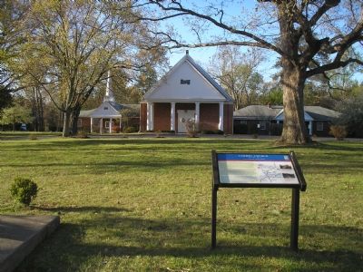
Location. 37° 55.806′ N, 77° 28.812′ W. Marker is in Ruther Glen, Virginia, in Caroline County. Marker is at the intersection of Jericho Road (Virginia Route 207) and Jefferson Davis Highway (U.S. 1), on the left when traveling south on Jericho Road. Touch for map. Marker is at or near this postal address: 24320 Jefferson Davis Hwy, Ruther Glen VA 22546, United States of America. Touch for directions.
Other nearby markers. At least 8 other markers are within 3 miles of this marker, measured as the crow flies. The Hermon Baptist Association Memorial (here, next to this marker); Grant’s Operations (about 400 feet away, measured in a direct line); Stalemate
(approx. 2.6 miles away); Dig and Dig Some More (approx. 2.6 miles away); Reinforcements Arrive (approx. 2.6 miles away); A Night of Agony (approx. 2.6 miles away); Death Under The Trees (approx. 2.6 miles away); Griffin's Artillery (approx. 2.6 miles away). Touch for a list and map of all markers in Ruther Glen.
Also see . . . The Overland Campaign of 1864. American Battlefield Trust website entry (Submitted on November 21, 2022, by Larry Gertner of New York, New York.)
Credits. This page was last revised on April 3, 2024. It was originally submitted on November 19, 2007, by Bill Coughlin of Woodland Park, New Jersey. This page has been viewed 4,016 times since then and 332 times this year. Photos: 1, 2. submitted on November 19, 2007, by Bill Coughlin of Woodland Park, New Jersey. • Kevin W. was the editor who published this page.

