Ruther Glen in Caroline County, Virginia — The American South (Mid-Atlantic)
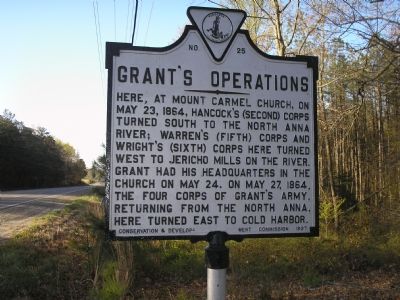
Grant’s Operations
Erected 1927 by Conservation & Development Commission. (Marker Number E-25.)
Topics and series. This historical marker is listed in this topic list: War, US Civil. In addition, it is included in the Former U.S. Presidents: #18 Ulysses S. Grant, and the Virginia Department of Historic Resources (DHR) series lists. A significant historical month for this entry is May 1864.
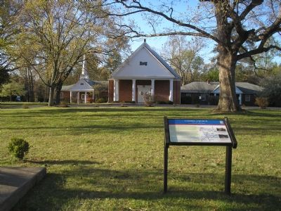
Location. 37° 55.751′ N, 77° 28.777′ W. Marker is in Ruther Glen, Virginia, in Caroline County. Marker is at the intersection of Jefferson Davis Highway (U.S. 1) and Jericho Road (Virginia Route 207), on the right when traveling south on Jefferson Davis Highway. The marker is just south of Route 207, off Roundabout Rd, near Carmel Church. Touch for map. Marker is at or near this postal address: 24320 Jefferson Davis Hwy, Ruther Glen VA 22546, United States of America. Touch for directions.
Other nearby markers. At least 8 other markers are within 3 miles of this marker, measured as the crow flies. The Hermon Baptist Association Memorial (about 400 feet away, measured in a direct line); Carmel Church (about 400 feet away); Stalemate (approx. 2˝ miles away); Reinforcements Arrive (approx. 2˝ miles away); Dig and Dig Some More (approx. 2˝ miles away); A Night of Agony (approx. 2˝ miles away); Long Creek Action (approx. 2.6 miles away); Death Under The Trees (approx. 2.6 miles away). Touch for a list and map of all markers in Ruther Glen.
More about this marker. The marker is labeled “NO-25” but is listed in marker guidebooks from the 1930s to the present as “E-25”.
Credits. This page was last revised on April 3, 2024. It was originally submitted on November 19, 2007, by Bill Coughlin of Woodland Park, New Jersey. This page has been viewed 1,403 times since then and 28 times this year. Photos: 1, 2. submitted on November 19, 2007, by Bill Coughlin of Woodland Park, New Jersey. • Kevin W. was the editor who published this page.
Editor’s want-list for this marker. Wide area picture of Grant’s Operations marker. • Can you help?

