High Bridge in Hunterdon County, New Jersey — The American Northeast (Mid-Atlantic)
Lake Solitude and Taylor Falls
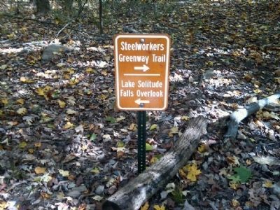
Tayor Steelworkers Historic Greenway
— A 7 Mile Greenway Trail Through the Borough of High Bridge Historic Properties —
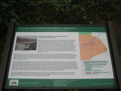
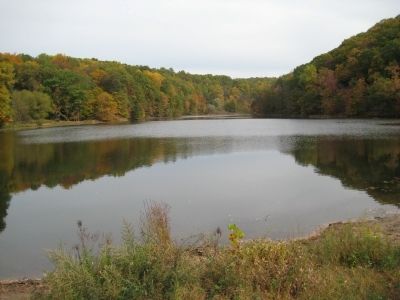
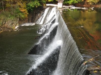
With the depletion of natural resources that provided energy to power the adjacent Iron Works, Lake Solitude was constructed by the Taylor Iron and Steel Company in 1858 to provide hydro-electric power for the works. Lake Solitude is approximately 20 acres in size, and is on the South Branch of the Raritan River. The 500 foot long earthen portion of the dam structure is a gravity dam and had been expanded and increased in height over the years to its current size. The 175 foot long spillway, or fall structure, was originally constructed as a timber framed "crib" dam and named so after its specific type of construction. The original spillway structure was locally known as Taylor Falls, and named after Robert Taylor, the first of five generations of Taylors who came to live at Solitude and manage the Union Iron Works through the Taylor Wharton Iron and Steel Company until the 1920's.
From the time of its construction, Lake Solitude not only provided a functional use as a power source for the foundry, but a destination as a popular recreation area for the local residents and beyond. Various swim and recreation clubs were established at Lake Solitude along with the forgotten adjacent Camp Taylor. From the time of the lake's creation, boating, fishing, swimming and beach recreation were all part of Lake Solitude's various uses. In the early years, Lake Solitude was a destination of train excursions and the site of extravagant Independence Day celebrations by the Iron Works.
In 1909 the Crib Dam was replaced by the current 40 foot high spillway structure, and is a highly significant example of dam engineering known as the Butress Dam. The dam was designed and constructed by renowned master civil engineer Frank Stone Tainter. Tainter also built other significant dams in New Jersey including the Lake Carnegie Dam in Princeton, and the Ravine Lake Dam in Far Hills. The Lake Solitude Butress Dam is unique and historic due to its construction type. The substructure of the stone dam is constructed with concrete encased steel beams anchored into the bedrock and reinforced with the butress structures. This dam structure is the earliest example of this construction type, and the last remaining example of a butress dam in New Jersey. The structure is currently recognized by the state and nationally as a significant historic structure. Today, the spillway is once again called the Taylor Falls as a lasting legacy to the Taylor Family.
The Union Forge Heritage Association was actively involved with the preservation and adaptive re-use of Lake Solitude as a historically significant part of High Bridge's past, as well as a viable part of its future with the proposed re-introduction of hydro-power to the lake. Lake Solitude and Dam were listed on Preservation NJ's Most Endangered Sites in 2008.
Erected by The Union Forge Heritage Association and the Borough of High Bridge.
Topics. This historical marker is listed in these topic lists: Bridges & Viaducts • Industry & Commerce • Waterways & Vessels. A significant historical year for this entry is 1858.
Location. 40° 40.265′ N, 74° 53.192′ W. Marker is in High Bridge, New Jersey, in Hunterdon County. Marker is on River Road, on the right when traveling south. Touch for map. Marker is in this post office area: High Bridge NJ 08829, United States of America. Touch for directions.
Other nearby markers. At least 8 other markers are within walking distance of this marker. Solitude House (a few steps from this marker); Solitude (within shouting distance of this marker); Union Forge (within shouting distance of this marker); Union Forge Bridge (about 700 feet away, measured in a direct line); The TISCO Complex (approx. 0.2 miles away); Solitude Falls (approx. 0.3 miles away); Taylor Steelworkers Historic Greenway (approx. 0.3 miles away); Old Iron Mines (approx. 0.4 miles away). Touch for a list and map of all markers in High Bridge.
Additional keywords. Dams
Credits. This page was last revised on June 16, 2016. It was originally submitted on October 18, 2010, by Alan Edelson of Union Twsp., New Jersey. This page has been viewed 1,578 times since then and 34 times this year. Photos: 1, 2, 3, 4. submitted on October 18, 2010, by Alan Edelson of Union Twsp., New Jersey. 5. submitted on October 17, 2010, by William Honachefsky Jr of High Bridge/Clinton Twp, New Jersey. • Syd Whittle was the editor who published this page.
