Near Sandston in Henrico County, Virginia — The American South (Mid-Atlantic)
White Oak Swamp
Controversy for Stonewall Jackson
— 1862 Peninsula Campaign —
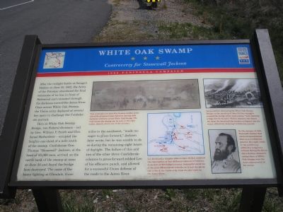
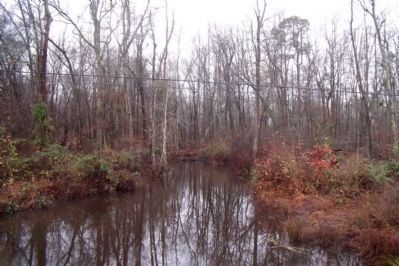
Here at White Oak Swamp Bridge, two Federal divisions – led by Gen. William F. Smith and Gen. Israel Richardson – occupied the heights one-third of a mile south of the swamp. Confederate Gen. Thomas “Stonewall” Jackson, at the head of 25,000 men, arrived on the north bank of the swamp at noon on June 30 and found the bridge here destroyed. The noise of the heavy fighting at Glendale, three miles to the southwest, “made me eager to press forward,” Jackson later wrote, but he was unable to do so during the remaining eight hours of daylight. The failure of this and two of the other three Confederate columns to press forward robbed Lee of his offensive punch, and allowed for a successful Union defense of the roads to the James River.
Erected by Virginia Civil War Trails.
Topics and series. This historical marker is listed in this topic list: War, US Civil. In addition, it is included in the Virginia Civil War Trails series list. A significant historical month for this entry is June 1855.
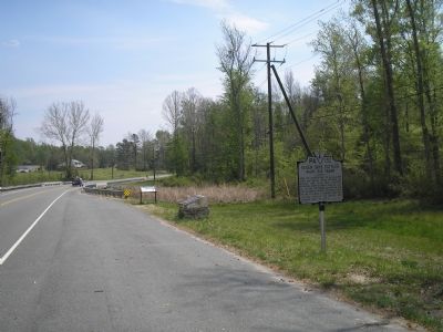
Location. This marker has been replaced by another marker nearby. It was located near 37° 28.142′ N, 77° 12.543′ W. Marker was near Sandston, Virginia, in Henrico County. Marker was at the intersection of Elko Road (County Route 156), on the right when traveling south on Elko Road. Touch for map. Marker was at or near this postal address: 7091 Elko Rd, Sandston VA 23150, United States of America. Touch for directions.
Other nearby markers. At least 8 other markers are within 2 miles of this location, measured as the crow flies. A different marker also named White Oak Swamp (here, next to this marker); a different marker also named White Oak Swamp (a few steps from this marker); Seven Days Battles (approx. 0.4 miles away); a different marker also named Seven Days Battles (approx. ¾ mile away); Decoy Airfield (approx. 1.4 miles away); Elko Community Center (approx. 1.7 miles away); Riddell's Shop (approx. 2.1 miles away); Glendale (Frayser’s Farm) (approx. 2.1 miles away). Touch for a list and map of all markers in Sandston.
More about this marker. In the upper center is "This contemporary sketch by famous combat artist Alfred Waud shows Union batteries dueling with Jackson’s artillery across White Oak Swamp. The road across the swamp can be seen in the right center, directly above one of the cannons."
On the upper right is a drawing showing "Union soldiers

Photographed By Bill Coughlin, April 25, 2007
2. White Oak Swamp Battle Map
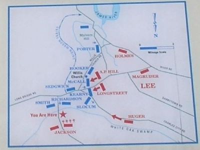
Lee developed a complex plan on June 30 that involved the convergence of four different columns of infantry in pursuit of McClellan’s retreat. Successful execution of the plan offered great rewards, as it had the potential to block the Union army from its bases on the James River.
A center map is captioned: "Lee developed a complex plan on June 30 that involved the convergence of four different columns of infantry in pursuit of McClellan’s retreat. Successful execution of the plan offered great rewards, as it had the potential to block the Union army from its bases on the James River."
A portrait of General Jackson on the right side is captioned, "By the summer of 1862, Stonewall Jackson had achieved international fame as a Confederate general. His rapid climb in the public’s eye suffered a temporary setback during the Seven Day’s Battles. Jackson’s actions here at White Oak Swamp were the most controversial of his career."
Related marker. Click here for another marker that is related to this marker. New Marker At This Location also titled "White Oka Swamp".
Also see . . .
1. Battle of White Oak Swamp. (Submitted on November 28, 2007, by Craig Swain of Leesburg, Virginia.)
2. White Oak Swamp. Details about the bridge, swamp, and the marker placement with regard to the historical landmarks. (Submitted on November 28, 2007, by Craig Swain of Leesburg, Virginia.)
Credits. This page was last revised on April 21, 2022. It was originally submitted on November 20, 2007, by Bill Coughlin of Woodland Park, New Jersey. This page has been viewed 2,894 times since then and 58 times this year. Photos: 1, 2, 3. submitted on November 20, 2007, by Bill Coughlin of Woodland Park, New Jersey. 4. submitted on November 25, 2009, by Bernard Fisher of Richmond, Virginia. • Craig Swain was the editor who published this page.


