Niagara-on-the-Lake in Niagara Region, Ontario — Central Canada (North America)
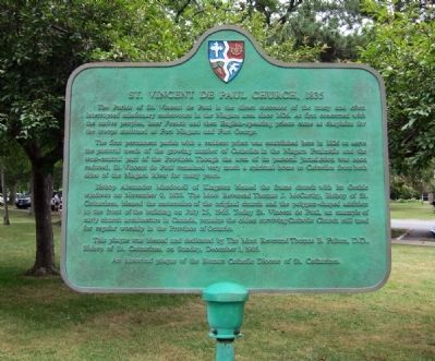
St. Vincent de Paul Church, 1835
Photographed by Andrew Ruppenstein, August 21, 2010
1. St. Vincent de Paul Church, 1835 Marker
The first permanent parish with a resident priest was established here in 1826 to serve the pastoral needs of the growing number of Catholics in the Niagara Peninsula and the west-central part of the Province. Though the area of its pastoral jurisdiction was soon reduced, St. Vincent de Paul remained very much a spiritual home to Catholics on both sides of the Niagara River for many years.
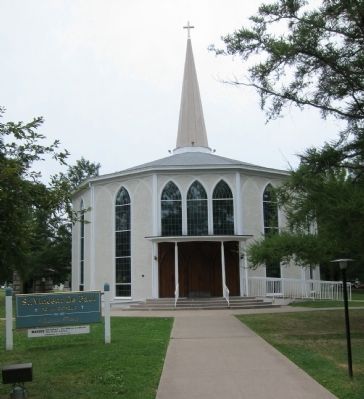
Bishop Alexander Macdonell of Kingston blessed the frame church with its Gothic windows on November 9, 1835. The Most Reverend Thomas J. McCarthy, Bishop of St. Catherines, blessed the restoration of the original church and the polygon-shaped addition to the front of the building on July 25, 1965. Today St. Vincent de Paul, an example of early church architecture in Canada, remains the oldest surviving Catholic Church still used for worship
this page online
This plaque was blessed and dedicated by the Most Reverend Thomas B. Fulton, D.D., Bishop of St. Catherines, December 1, 1985.
An historical plaque of the Roman Catholic Diocese of St. Catherines.
Erected 1985 by Roman Catholic Diocese of St. Catherine.
Topics. This historical marker is listed in this topic list: Religion & Religious Structures. A significant historical date for this entry is July 25, 1965.
Location. 43° 15.21′ N, 79° 4.076′ W. Marker is in Niagara-on-the-Lake, Ontario, in Niagara Region. It is at the intersection of Picton Street and Wellington Street, on the left on Picton Street. Touch for map. Marker is at or near this postal address: 73 Picton Street, Niagara-on-the-Lake ON L0S 1J0, Canada. Touch for directions.

Regionally, this marker is on Ontario’s Golden Horseshoe and in Niagara Canada. It is also in Central Canada. Globally, it is in North America, on the Great Lakes, in the Western Hemisphere, in the Western World, and in the Anglosphere. Historically, it finds itself in what was once a British colony, the Viceroyalty of New France, the Haudenosaunee (Iroquois)
Photographed by Andrew Ruppenstein, August 21, 2010
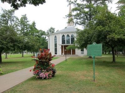
2. St. Vincent de Paul Church, 1835 Marker - wide view
Other nearby markers. At least 8 other markers are within walking distance of this marker: Polish Soldier’s Burial Plot 1917 – 1919 (about 150 meters away, measured in a direct line); Butler's Rangers (about 180 meters away); St. Mark’s Church (about 180 meters away); Centennial of Confederation (about 210 meters away); Town of Niagara (approx. 0.2 kilometers away); Upper Canada Gazette, or American Oracle (approx. 0.3 kilometers away); First Legislative Assembly of Upper Canada (approx. 0.3 kilometers away); John Graves Simcoe (approx. 0.3 kilometers away). Touch for a list and map of all markers in Niagara-on-the-Lake.
More about this marker. The marker is mounted on a pole to the immediate right of the sidewalk that leads from the street to the church.
Photographed by Andrew Ruppenstein, August 21, 2010
3. St. Vincent de Paul Church (1835)
Photographed by Andrew Ruppenstein, August 21, 2010
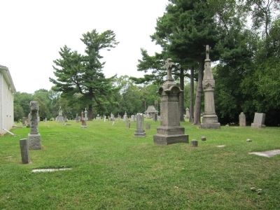
4. View of St. Vincent de Paul cemetery - behind church, as seen from Picton St.
Credits. This page was last revised on September 27, 2019. It was originally submitted on October 25, 2010, by Andrew Ruppenstein of Lamorinda, California. This page has been viewed 1,490 times since then and 48 times this year. Photos: 1, 2, 3, 4. submitted on October 25, 2010, by Andrew Ruppenstein of Lamorinda, California. • Syd Whittle was the editor who published this page.
