Upper Marlboro in Prince George's County, Maryland — The American Northeast (Mid-Atlantic)
Tomb of Dr. William Beanes
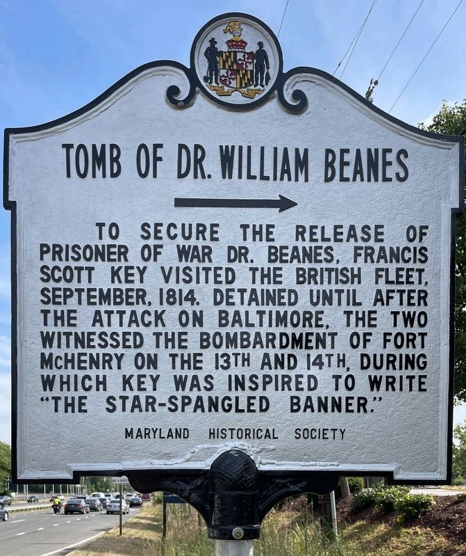
Photographed by Rico Ramirez, June 25, 2024
1. Tomb of Dr. William Beanes Marker
Erected 1966 by Maryland Historical Society.
Topics and series. This historical marker is listed in these topic lists: Arts, Letters, Music • Cemeteries & Burial Sites • Patriots & Patriotism • War of 1812. In addition, it is included in the Maryland Historical Trust series list. A significant historical year for this entry is 1814.
Location. 38° 49.149′ N, 76° 44.203′ W. Marker is in Upper Marlboro, Maryland, in Prince George's County. It is on Crain Highway (U.S. 301) 0.3 miles south of Marlboro Pike (Maryland Route 725), on the right when traveling south. Touch for map. Marker is in this post office area: Upper Marlboro MD 20772, United States of America. Touch for directions.

Regionally, this marker is in the Washington Metropolitan Area. It is also in the American South, specifically in the Upper South,
this page online
Other nearby markers. At least 8 other markers are within walking distance of this marker: Welcome To The Town of Upper Marlboro (approx. half a mile away); Tried for Treason (approx. 0.6 miles away); a different marker also named Darnall's Chance Burial Vault (approx. 0.7 miles away); Filming "Black Like Me" in Upper Marlboro (approx. 0.7 miles away); The Right Will Prevail (approx. ¾ mile away); The Walk of History (approx. ¾ mile away); This White Oak Tree (approx. ¾ mile away); Schoolhouse Pond (approx. ¾ mile away). Touch for a list and map of all markers in Upper Marlboro.
Another marker is no longer nearby. Darnall’s Chance Burial Vault (was approx. 0.7 miles away but has been replaced with another marker now near it).
More about this marker. There is an identical marker located on Pennsylvania Avenue (MD 4), two tenths
Photographed by F. Robby, December 31, 2003
2. Tomb of Dr. William Beanes Marker
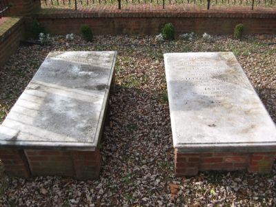
Photographed by F. Robby, December 2, 2004
3. Tomb of Dr. William Beanes
The tomb is located in a small park at the intersection of Elm Street and Governor Oden Bowie Drive, about 1.5 miles west of this marker.
Credits. This page was last revised on December 29, 2024. It was originally submitted on November 20, 2007, by F. Robby of Baltimore, Maryland. This page has been viewed 3,359 times since then and 111 times this year. Photos: 1. submitted on July 22, 2024, by Rico Ramirez of Prince Frederick, Maryland. 2, 3. submitted on November 20, 2007, by F. Robby of Baltimore, Maryland.
