
Mendota Heights in Dakota County, Minnesota — The American Midwest (Upper Plains)
Pilot Knob
Photographed by Keith L, October 28, 2010
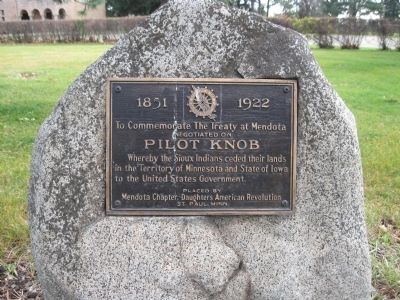
1. Pilot Knob Marker
[symbol of the D.A.R.]
To Commemorate The Treaty at Mendota
Negotiated on
Pilot Knob
Mendota Chapter, Daughters American Revolution
St. Paul, Minn.
Erected 1922 by Mendota Chapter of the Daughters of the American Revolution.
Topics and series. This historical marker is listed in this topic list: Indigenous Peoples and Communities. In addition, it is included in the Daughters of the American Revolution (DAR) series list. A significant historical year for this entry is 1851.
Location. 44° 52.702′ N, 93° 10.114′ W. Marker is in Mendota Heights, Minnesota, in Dakota County. It can be reached from the intersection of Pilot Knob Road (County Road 31) and Acacia Boulevard. Marker is in Acacia Park Cemetery. Touch for map. Marker is at or near this postal address: 2151 Pilot Knob Road, Saint Paul MN 55120, United States of America. Touch for directions.

Regionally, this marker is in the Twin Cities Metropolitan Area. It is also in the American Midwest, in the Corn
this page online
Other nearby markers. At least 8 other markers are within walking distance of this marker: United States War Veterans Memorial (about 800 feet away, measured in a direct line); Oheyawahi Pilot Knob Hill (approx. 0.2 miles away); Oheyawahi "a hill much visited" (approx. ¼ mile away); Mendota / Sibley House (approx. 0.4 miles away); St. Peter's Church (approx. half a mile away); A Great River's Road / Mendota, the Meeting Place (approx. 0.6 miles away); Paper Towns & Other Imaginary Worlds / Frontier Fortunes and Mississippi Mansions (approx. 0.6 miles away); Mendota Work Camp No. 1 (approx. 0.6 miles away). Touch for a list and map of all markers in Mendota Heights.
Additional keywords. Pilot's Knob
Photographed by Keith L, October 28, 2010
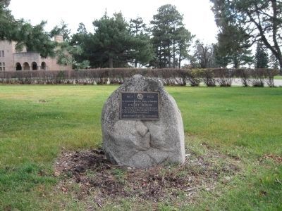
2. Pilot Knob Marker
Photographed by Keith L, October 28, 2010
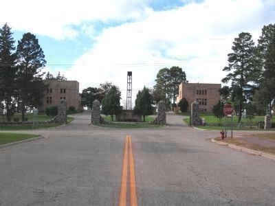
3. Acacia Park Cemetery
The marker is beyond the right side office building.
Credits. This page was last revised on November 21, 2020. It was originally submitted on October 31, 2010, by Keith L of Wisconsin Rapids, Wisconsin. This page has been viewed 2,083 times since then and 28 times this year. Photos: 1, 2, 3. submitted on October 31, 2010, by Keith L of Wisconsin Rapids, Wisconsin.
