Amherstburg in Essex County, Ontario — Central Canada (North America)
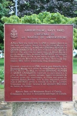
Amherstburg Navy Yard
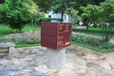
A Navy Yard was built here in 1796 to replace Detroit as the base and supply depot for the Provincial Marine on Lakes Erie and Huron. In 1812 the GENERAL HUNTER and QUEEN CHARLOTTE, built here, took part in the capture of Detroit. The next year, his supply lines cut, Robert Barclay's poorly equipped fleet, including the DETROIT, was defeated by Oliver Perry, U.S.N., in the battle of Lake Erie. This reverse led the British to burn the Navy Yard on 22 September, 1813, before withdrawing from Amherstburg.
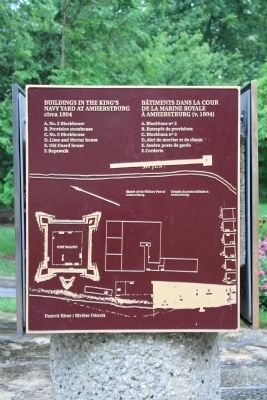
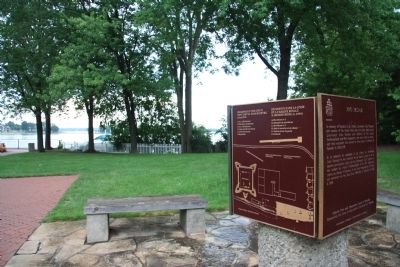
[South Historic Marker]:Buildings in the King's Navy Yard at Amherstburg
Buildings in the King's Navy Yard at Amherstburg circa 1804
A. No. 2 Blockhouse
B. Provision storehouse
C. No. 3 Blockhouse
D. Lime and Mortar house
E. Old Guard house
F. Ropewalk
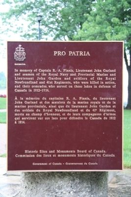
[East Historic Marker]:Pro Patria
In memory of Captain R.A. Finnis, Lieutenant John Garland and seamen of the Royal Navy and Provincial Marine and Lieutenant John Garden and soldiers of the Royal Newfoundland and 41st Regiments, who were killed in action, and their comrades who served on these lakes in defense of Canada in 1812-1814.
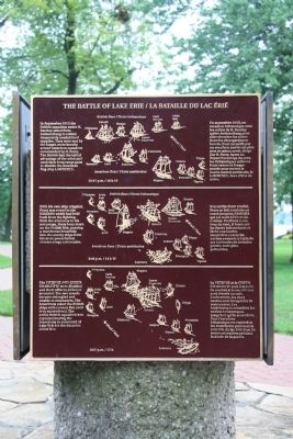
[North Historic Marker]:The Battle of Lake Erie
In September 1813 the British squadron under R. Barclay sailed from Amherstburg to collect desperately needed food supplies. They were met by the larger, more heavily armed American squadron commanded by O. Perry. The British had the initial advantage of the wind and used their long range guns to disable the American flag ship LAWRENCE.
With his own ship crippled, Perry was rowed to the NIAGARA which had held back from the fighting. With the wind now to his advantage, Perry bore down on the British line, pouring a murderous broadside into the enemy ships from his more powerful but shorter range carronades.
The DETROIT and QUEEN CHARLOTTE were disabled and their officers, killed or wounded. The two vessels became entangled and unable to manoeuvre. The Americans raked the British ships with cannon fire until they surrendered. The entire British squadron was captured leaving the Americans in command of Lake Erie for the duration of the War.
Erected by Historic Sites and Monuments Board of Canada.
Topics and series. This historical marker is listed in this topic list: War of 1812. In addition, it is included in the Canada, Historic Sites and Monuments Board series list. A significant historical date for this entry is September 22, 1813.
Location. 42° 6.205′ N, 83° 6.844′ W. Marker is in Amherstburg
, Ontario, in Essex County. Marker can be reached from Dalhousie Street west of Rankin Avenue. This historical marker is located in the downtown area, in a national historic park, located along the Detroit River. Touch for map. Marker is at or near this postal address: 224 Dalhousie St, Amherstburg ON N9V 1W4, Canada. Touch for directions.
Other nearby markers. At least 8 other markers are within walking distance of this marker. The Battle of Lake Erie (here, next to this marker); The Commissariat Office (within shouting distance of this marker); The Great Sauk Trail (about 90 meters away, measured in a direct line); Connection to Town (approx. 0.3 kilometers away); Boblo Island (approx. 0.3 kilometers away); Strategic Location (approx. 0.3 kilometers away); Brick Officers’ Guard Room (approx. 0.4 kilometers away); The Site Over Time (approx. 0.4 kilometers away). Touch for a list and map of all markers in Amherstburg.
Related markers. Click here for a list of markers that are related to this marker. To better understand the relationship, study each marker in the order shown.
Credits. This page was last revised on January 24, 2022. It was originally submitted on November 4, 2010, by Dale K. Benington of Toledo, Ohio. This page has been viewed 1,364 times since then and 17 times this year. Photos: 1, 2, 3, 4, 5, 6, 7. submitted on November 6, 2010, by Dale K. Benington of Toledo, Ohio.
