Baxter Springs in Cherokee County, Kansas — The American Midwest (Upper Plains)
Fort Blair Breastworks
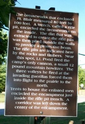
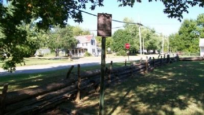
The breastworks that enclosed Ft. Blair measured 80 feet by 100 feet. A trench, called a rifle pit, encircled the breastworks on the inside. The dirt that was extracted to create the rifle pits was then piled outside the walls to provide a protective berm. The rifle pits are indicated here by the rocks and timbers. Near this spot, Lt. Pond fired the camp's only cannon, a small 12 pound mountain howitzer. The three volleys he fired at the invading guerillas forced them into flight to the prairie to the north.
Tents to house the enlisted men encircled the encampment just inside the rifle pit trench. A corridor was left down the center of the encampment.
Erected by Baxter Springs Historical Society.
Topics. This historical marker is listed in these topic lists: Forts and Castles • War, US Civil.
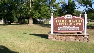
Location. 37° 1.782′ N, 94° 44.038′ W. Marker is in Baxter Springs, Kansas, in Cherokee County. Marker is on 6th Street near Military Avenue (U.S. 69), on the right when traveling east. Marker is in the Fort Blair Historic Site. Touch for map. Marker is in this post office area: Baxter Springs KS 66713, United States of America. Touch for directions.
Other nearby markers. At least 8 other markers are within walking distance of this marker. Fort Blair Blockhouse (a few steps from this marker); John Baxter (a few steps from this marker); Fort Blair West Breastworks (a few steps from this marker); Baxter Springs Massacre Burial Site (within shouting distance of this marker); Fort Blair (within shouting distance of this marker); Battle of Baxter Springs (within shouting distance of this marker); The Battle For Fort Blair (within shouting distance of this marker); 2nd Kansas Colored Infantry at Fort Blair (within shouting distance of this marker). Touch for a list and map of all markers in Baxter Springs.
Also see . . .
1. Fort Blair, Kansas & the Baxter Springs Massacre. Legends of America website entry (Submitted on November 6, 2010, by William Fischer, Jr. of Scranton, Pennsylvania.)
2. Battle of Baxter Springs. Wikipedia entry (Submitted on November 6, 2010, by William Fischer, Jr. of Scranton, Pennsylvania.)
3. Baxter Springs, Kansas. Wikipedia entry (Submitted on September 20, 2023, by Larry Gertner of New York, New York.)
Credits. This page was last revised on September 20, 2023. It was originally submitted on November 6, 2010, by William Fischer, Jr. of Scranton, Pennsylvania. This page has been viewed 871 times since then and 7 times this year. Photos: 1, 2, 3. submitted on November 6, 2010, by William Fischer, Jr. of Scranton, Pennsylvania.


