Princeton in Mercer County, West Virginia — The American South (Appalachia)
Battle of Pigeon's Roost
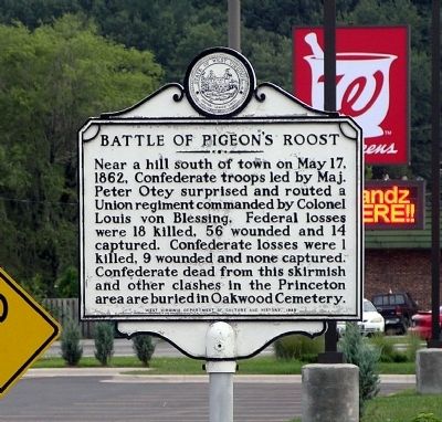
Photographed by Paul Crumlish, August 21, 2010
1. Battle of Pigeon's Roost Marker
Erected 1980 by West Virginia Department of Culture and History.
Topics and series. This historical marker is listed in this topic list: War, US Civil. In addition, it is included in the West Virginia Archives and History series list. A significant historical month for this entry is May 1981.
Location. 37° 21.692′ N, 81° 6.291′ W. Marker is in Princeton, West Virginia, in Mercer County. It is on South Walker Street (U.S. 19) 0.1 miles north of Stafford Drive (West Virginia Route 104), on the right when traveling north. The marker is located at the former intersection of Old Bluefield Road and South Walker Street. Old Bluefield Road has been abandoned as a thoroughfare and now serves as a service road and parking lot adjacent to South Walker
this page online

Regionally, this marker is in the Southern Coalfields. It is also in the American South, specifically in the Upper South, in Appalachia, and specifically in Southern Appalachia. Globally, it is in North America, the Western Hemisphere, the Western World, and the Anglosphere. Historically, it finds itself in what was once the territory of the Mississippian Culture.
Other nearby markers. At least 8 other markers are within walking distance of this marker: American Revolution Bicentennial Bell (approx. 0.3 miles away); Richard Blankenship (approx. 0.3 miles away); Princeton (approx. 0.3 miles away); Those Who Served War Museum (approx. 0.3 miles away); To The Memory of Gen. Hugh Mercer (approx. 0.3 miles away); McNutt House (approx. 0.4 miles away); Napoleon Bonaparte French (approx. half a mile away); Confederate Dead (approx. half a mile away). Touch for a list and map of all markers in Princeton.
Also see . . . Battle of Pigeon Roost - WV Encyclopedia.
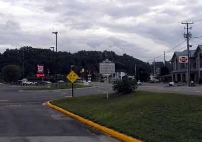
Photographed by Paul Crumlish, August 21, 2010
2. Wide view of the Battle of Pigeon's Roost Marker
Credits. This page was last revised on October 18, 2016. It was originally submitted on November 9, 2010, by PaulwC3 of Northern, Virginia. This page has been viewed 2,491 times since then and 72 times this year. Photos: 1, 2. submitted on November 9, 2010, by PaulwC3 of Northern, Virginia.
Editor’s want-list for this marker. Photos of Pigeon's Roost battlefield • Can you help?
