Near Baxter Springs in Cherokee County, Kansas — The American Midwest (Upper Plains)
Baxter Springs Massacre
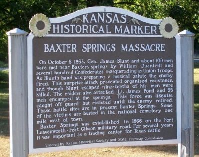
On October 6, 1863, Gen. James Blunt and about 100 men were met near Baxter’s springs by William Quantrill and several hundred Confederates masquerading as Union troops. As Blunt’s band was preparing a musical salute the enemy fired. This surprise attack prevented organized resistance, and though Blunt escaped nine-tenths of his men were killed. The raiders also attacked Lt. James Pond and 95 men encamped at the springs. This force was likewise caught off guard but resisted until the enemy retired. These battle sites are in present Baxter Springs. Some of the victims are buried in the national cemetery one mile west of town.
Baxter Springs was established in 1866 on the Fort Leavenworth-Fort Gibson military road. For several years it was important as a trading center for Texas cattle.
Erected by Kansas Historical Society and State Highway Commission. (Marker Number 49.)
Topics and series. This historical marker is listed in these topic lists: Forts and Castles • Industry & Commerce • Roads & Vehicles • War, US Civil. In addition, it is included in the Kansas Historical Society series list. A significant historical month for this entry is October 1803.
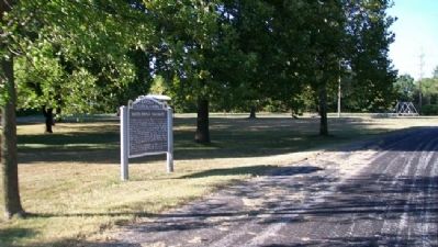
Location. 37° 4.013′ N, 94° 43.585′ W. Marker is near Baxter Springs, Kansas, in Cherokee County. Marker is on U.S. 69/400, 0.2 miles south of SE Varck Road, on the right when traveling south. Marker is in the Old Route 66 Park (roadside rest area). Touch for map. Marker is in this post office area: Baxter Springs KS 66713, United States of America. Touch for directions.
Other nearby markers. At least 8 other markers are within walking distance of this marker. Fort Blair (approx. 0.8 miles away); Where Two Roads Converge (approx. 0.8 miles away); Baxter Springs Massacre and Today (approx. 0.8 miles away); Bridging the American Divide (approx. 0.8 miles away); Boom Towns (approx. 0.8 miles away); Cosmopolitan Corner (approx. 0.8 miles away); Crossroads of Kansas (approx. 0.8 miles away); Land's Legacy (approx. 0.8 miles away).
Related markers. Click here for a list of markers that are related to this marker.
Also see . . .
1. Fort Blair, Kansas & the Baxter Springs Massacre. Legends of America website entry (Submitted on November 11, 2010, by William Fischer, Jr. of Scranton, Pennsylvania.)
2. Battle of Baxter Springs. Wikipedia entry (Submitted on November 11, 2010, by William Fischer, Jr. of Scranton, Pennsylvania.)
3. Baxter Springs Heritage Center & Museum. Website homepage (Submitted on October 7, 2023, by Larry Gertner of New York, New York.)
Credits. This page was last revised on April 5, 2024. It was originally submitted on November 11, 2010, by William Fischer, Jr. of Scranton, Pennsylvania. This page has been viewed 1,784 times since then and 88 times this year. Photos: 1, 2. submitted on November 11, 2010, by William Fischer, Jr. of Scranton, Pennsylvania.

