Poughkeepsie in Dutchess County, New York — The American Northeast (Mid-Atlantic)
Walkway Over the Hudson
Photographed by Michael Herrick, November 2, 2010
1. Walkway Over the Hudson Marker
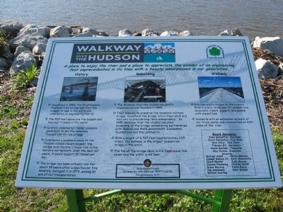
• The 525 foot spans are the largest and heaviest trusses in the world.
• 10 story underwater timber caissons were built to set the concrete foundations for the bridge.
• Considered a landmark piece of the Hudson valleys industrial past, the bridge soon became a major link in the nation's rail network. Over the next 60 years, it would support 50 trains per day.
• The bridge has been virtually idle for about 35 years after a spectacular fire severely damaged it in 1974, ending an era of rail transportation.
• Their mission: to preserve the landmark railroad bridge, transform the bridge into a linear park and trail and to provide long-term stewardship. In 1995 Walkway Over the Hudson assumed
this page online
• With a length of 6,767 feet (approximately 1.25 miles), the walkway is the longest pedestrian bridge in the world.
• The top of the bridge deck is 212 above the water and the width is 24 feet.
• Connects with an extensive network of rail-trails, parks and communities on both sides of the river.
Donated by: Alex Palmiotti, BSA Troop 50
Poughkeepsie, NY
Erected 2009.
Topics. This historical marker is listed in these topic lists: Bridges & Viaducts
Photographed by Michael Herrick, November 2, 2010
2. Detail from the Marker
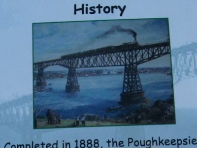
A train crosses the Poughkeepsie Railroad Bridge
Location. 41° 42.477′ N, 73° 56.419′ W. Marker is in Poughkeepsie, New York, in Dutchess County. It is at the intersection of Main Street and North Water Street, on the right when traveling west on Main Street. Located in Waryas Memorial Park on the Hudson River. Touch for map. Marker is in this post office area: Poughkeepsie NY 12601, United States of America. Touch for directions.

Regionally, this marker is in Upstate New York and in the Hudson Valley. It is also in the American Northeast, in the Mid-Atlantic, and on the Eastern Seaboard. Globally, it is in the North Atlantic Region, North America, the Western Hemisphere, the Western World, and the Anglosphere. Historically, it finds itself in what was once New Netherland and also one of the original Thirteen Colonies.
Other nearby markers. At least 8 other markers are within walking distance of this marker: Walkway Loop Trail (here, next to this marker); The Queen City of the Hudson (here, next to this marker); River That Flows Both Ways (about 600 feet away, measured in a direct line); Poughkeepsie Waterfront
Photographed by Michael Herrick, November 2, 2010
3. Detail from the Marker
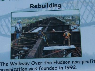
Construction workers on the bridge steelwork
Also see . . .
1. Walkway Over the Hudson. (Submitted on November 12, 2010, by Michael Herrick of Southbury, Connecticut.)
2. Poughkeepsie Railroad Bridge - National Archives. National Register of Historic Places documentation (Submitted on January 29, 2024, by Anton Schwarzmueller of Wilson, New York.)
Additional commentary.
1. Length and Width of Walkway
There are a few errors in the article.Walkway Over The Hudson is 6,768 feet long,and 1.28 miles long.It is 25 feet wide,not 24 feet as you have.Contact Walkway Over The Hudson staff and other sites for verification.Thank you for your time.
Gary Recht
mailto:[email protected]
— Submitted January 17, 2015.
Photographed by Michael Herrick, November 2, 2010
4. Detail from the Marker
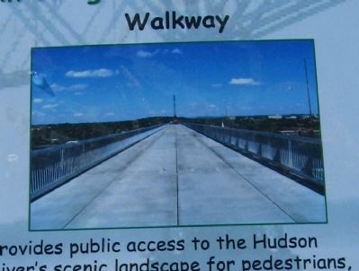
The completed Walkway
Photographed by Michael Herrick, November 2, 2010
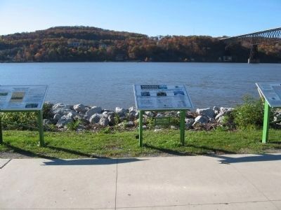
5. Walkway Over the Hudson Marker
Photographed by Michael Herrick, November 2, 2010
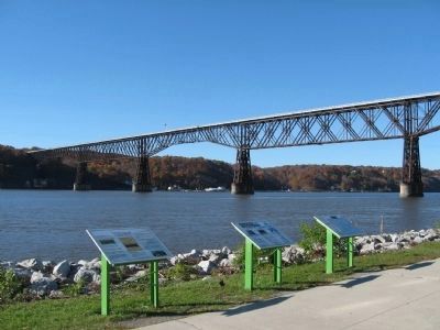
6. Walkway Over the Hudson Marker (center)
Walkway Over the Hudson, formerly the Poughkeepsie Railroad Bridge, spans the Hudson River
Credits. This page was last revised on January 29, 2024. It was originally submitted on November 12, 2010, by Michael Herrick of Southbury, Connecticut. This page has been viewed 1,740 times since then and 31 times this year. Photos: 1, 2, 3, 4, 5, 6. submitted on November 12, 2010, by Michael Herrick of Southbury, Connecticut.
