Near Millsboro in Sussex County, Delaware — The American Northeast (Mid-Atlantic)
Harmony United Methodist Church
Photographed by Mike Stroud, October 13, 2010
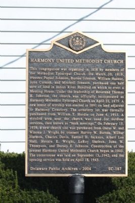
1. Harmony United Methodist Church Marker
Erected 2004 by Delaware Public Archives. (Marker Number SC-187.)
Topics and series. This historical marker is listed in these topic lists: Cemeteries & Burial Sites • Religion & Religious Structures. In addition, it is included in the Delaware Public Archives, and the National Register of Historic Places (NRHP) series lists. A significant historical month for this entry is February 1962.
Location. This marker has been replaced by another marker nearby. It was located near 38° 36.358′ N, 75° 13.119′ W. Marker was near Millsboro, Delaware, in Sussex County. It was on John J Williams Highway (Delaware Route 24), on the right when traveling west. Located between Tecumseh Pass and County Road 313. Touch for map.
this page online

Regionally, this marker was on Delaware’s Beaches. It was also in the American Mid-Atlantic, on the Delmarva Peninsula, and on the Eastern Seaboard. Globally, it was in the North Atlantic Region, North America, the Western Hemisphere, the Western World, and the Anglosphere. Historically, it found itself in what was once New Netherland, one of the original Thirteen Colonies, and the Antebellum South.
Other nearby markers. At least 8 other markers are within 3 miles of this location, measured as the crow flies: A different marker also named Harmony United Methodist Church (here, next to this marker); Indian Mission School (approx. 0.4 miles away); Rosedale Beach Hotel and Resort (approx. 0.9 miles away); Bullseye-Ferry Landing (approx. 1.3 miles away); Chair of Honor (approx. 1½ miles away); Veterans Memorial (approx. 1½ miles away); Patton Medium Tank (approx. 1½ miles away); Learning Garden (approx. 2.9 miles away). Touch for a list and map of all markers in Millsboro.
Another
Photographed by Mike Stroud, October 13, 2010
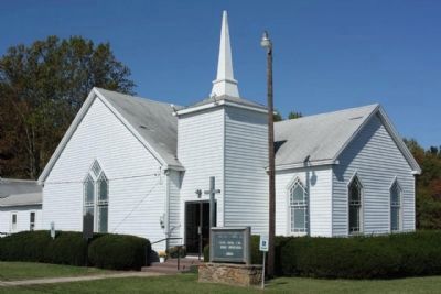
2. Harmony United Methodist Church and Marker
Regarding Harmony United Methodist Church. National Register of Historic Places:
Harmony Church ** (added 1979 - Building - #79003308)
Period of Significance: 1875-1899 •
Historic Function: Religion •
Historic Sub-function: Religious Structure •
Also see . . . Harmony Church - National Register of Historic Places Nomination Form.
Prior to 1888, Harmony Church served all the remnant Indian families of the Nanticoke community. After a bitter controversy over the hiring of a black minister, many of the separatist families withdrew. This property illustrates the institutional assimilation of some remnant Indian families into black society.(Submitted on April 24, 2025, by Pete Skillman of Wilmington, Delaware.)
Photographed by Mike Stroud, October 13, 2010
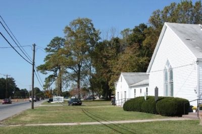
3. Harmony United Methodist Church Marker, looking west along John J. Williams Highway (State Route 24)
Photographed by Mike Stroud, October 13, 2010
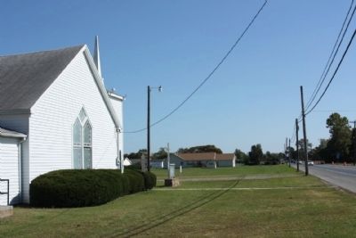
4. Harmony United Methodist Church Marker, looking east
Credits. This page was last revised on October 19, 2025. It was originally submitted on November 14, 2010, by Mike Stroud of Bluffton, South Carolina. This page has been viewed 1,794 times since then and 50 times this year. Photos: 1, 2, 3, 4. submitted on November 16, 2010, by Mike Stroud of Bluffton, South Carolina.
