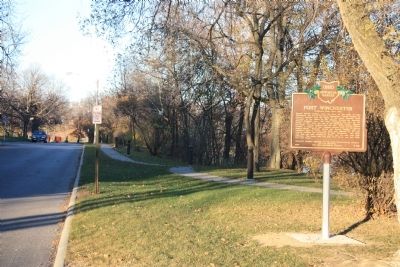
Defiance in Defiance County, Ohio — The American Midwest (Great Lakes)
Fort Winchester
Inscription.
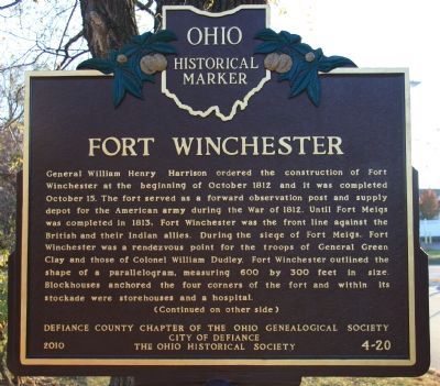
[Front Text] : "Fort Winchester"
General William Henry Harrison ordered the construction of Fort Winchester at the beginning of October 1812 and it was completed October 15. The fort served as a forward observation post and supply depot for the American army during the War of 1812. Until Fort Meigs was completed in 1813, Fort Winchester was the front line against the British and their Indian allies. During the siege of Fort Meigs, Fort Winchester was a rendezvous point for the troops of General Green Clay and those of Colonel William Dudley. Fort Winchester outlined the shape of a parallelogram, measuring 600 by 300 feet in size. Blockhouses anchored the four corners of the fort and within its stockade were storehouses and a hospital.
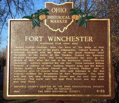
[Back Text] : "Fort Winchester"
Captain George Croghan, later the hero of the siege of Fort Stephenson, was one of the post's commanders. Colonel Richard M. Johnson, credited with the death of the great Shawnee chief Tecumseh at the Battle of the Thames, trained his Kentucky Mounted Regiment here. The Army abandoned the post in the spring of 1815, after the war in the Northwest ended. Shortly thereafter, settlers inhabited the old fort. These included William Preston, a veteran of Gen. Anthony Wayne's army and the Robert Shirley family. Benjamin Leavell and Horatio Phillips' plat of Defiance's grid of streets from 1822—still followed in the 21st century—outlines the boundaries of Fort Winchester. The fort's west wall was near Washington Street and the east wall near Jefferson. The north wall was near First Street and the south wall near Third.
Erected 2010 by Defiance County Chapter of the Ohio Genealogical Society, City of Defiance, and The Ohio Historical Society. (Marker Number 4-20.)
Topics and series. This historical marker is listed in these topic lists: Forts and Castles • War of 1812. In addition, it is included in the Former U.S. Presidents: #09 William Henry Harrison, and the Ohio Historical Society / The Ohio History Connection series lists. A significant historical year for this entry is 1812.
Location. 41° 17.141′ N, 84° 21.491′ W. Marker is in Defiance, Ohio, in Defiance County. Marker is on Washington Avenue north of West 2nd Street (Ohio Route 15), on the right when traveling north. This historical marker is located on the river side of Washington Avenue, along the Rotary Walkway. It is about 100 feet north of where the Winchester Bridge crosses the Auglaize River. Touch for map. Marker is in this post office area: Defiance OH 43512, United States of America. Touch for directions.
Other nearby markers. At least 8 other markers are within walking distance of this marker. A different marker also named Fort Winchester (within shouting distance
of this marker); Fort Winchester - Former Site Of North East Blockhouse (within shouting distance of this marker); Fort Winchester - Former Site Of North West Blockhouse (about 400 feet away, measured in a direct line); Fort Winchester - Former Site Of South East Blockhouse (about 500 feet away); Defiance Historic Sites (about 600 feet away); Fort Winchester - Former Site Of South West Blockhouse (about 600 feet away); a different marker also named Fort Winchester (about 600 feet away); Anthony Wayne's Fort Defiance (about 600 feet away). Touch for a list and map of all markers in Defiance.
More about this marker. When it was originally built Fort Winchester was situated on the west bank of the Auglaize River, just upstream from the location of Fort Defiance at the juncture of the Auglaize River with the Maumee River. When visiting Defiance, Ohio today, the Ohio Historical Marker for Fort Winchester can be viewed when traveling east from downtown Defiance on W. 2nd St. and looking on your left up Washington Avenue, just prior to crossing the bridge over the Auglaize
River.
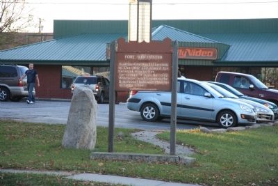
The Ohio Revolutionary Memorial Commission (ORMC) marker can be viewed by looking to your right, just prior to crossing the bridge over the Auglaize River (adjacent to the Family Video parking lot).
Regarding Fort Winchester. The War of 1812 was still in its infancy and already the American theater of military operations in the Northwest had suffered a serious setback. General Hull had marched an American army northward, through northwestern Ohio, to one of America's border's with Canada, at Fort Detroit. Once there however, instead of the anticipated successful invasion of Canada, Hull's army experienced a stunning defeat. And with the loss of General Hull's army the door was opened for the British to launch an invasion of conquest into Ohio.
To make matters worse, there was soon infighting between the Americans over who would assume command of the Northwestern military theater of operations. Initially it appeared that General William Henry Harrison would be the man in charge and he began the task of scrambling to secure as much as he could of what was now the contested territory between the British up in Detroit and the Americans down in southern and central Ohio. But then another general appeared on the scene, James Winchester, and he successfully argued that technically his commission outranked that of General
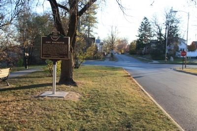
Photographed By Dale K. Benington, November 12, 2010
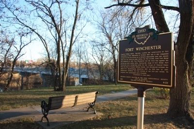
4. Fort Winchester Marker
View of the historical marker looking south, along Washington Avenue. Across the pictured intersection of Washington Avenue and West 2nd Street, and on the opposite side of the street, is the location of the ORMC historical marker for Fort Winchester.
So while it had been under General Winchester's command that the American army had advanced into the Fort Defiance area (the area at the juncture of the Auglaize River with the Maumee River), it would now be under the command of General Harrison that a major fort would be built there.
It is in his book (copyright 1905) entitled, "History of the Maumee River Basin" that Defiance native Charles E. Slocum writes about Fort Winchester and states: "General Harrison selected the site and drew the plan for a new fort to embrace over twelve times the ground space of Fort Defiance....As further evidence of the desire to respect and honor the commander of the Left Wing, the new fort at Defiance was duly christened Fort Winchester. This fort was completed by soldiers working with short and often unwholesome rations, thinly clad, and with much suffering from inclement weather; but it was happily completed and fulfilled its mission during the war as an important stronghold for the defense of the territory of the upper rivers, as a rendezvous for troops
and, later, for the storing of supplies to be boated down the Maumee River as wanted by the advancing troops. For some length of time it was the only obstruction against the incursions of the British and Aborigines into Northwestern Ohio."
Credits. This page was last revised on June 16, 2016. It was originally submitted on November 15, 2010, by Dale K. Benington of Toledo, Ohio. This page has been viewed 1,421 times since then and 67 times this year. Photos: 1, 2, 3, 4, 5, 6. submitted on November 15, 2010, by Dale K. Benington of Toledo, Ohio.
