Springfield in Fairfax County, Virginia — The American South (Mid-Atlantic)
The Orange And Alexandria Railroad Trestle
Photographed by Devry Becker Jones (CC0), October 1, 2026
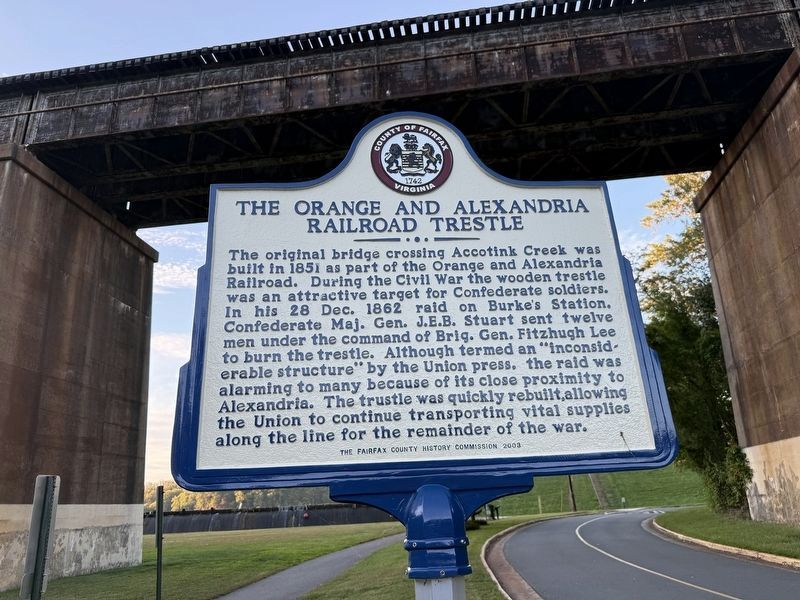
1. The Orange And Alexandria Railroad Trestle Marker
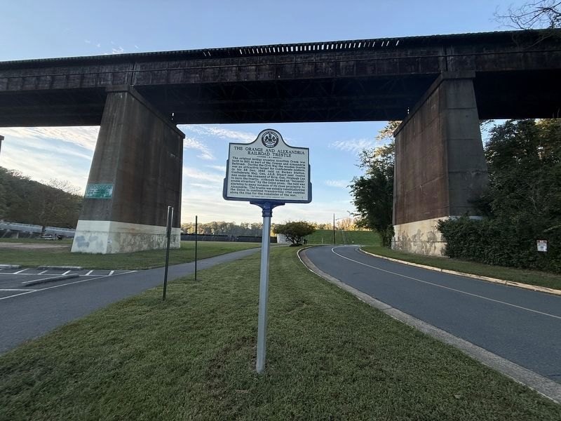
The original bridge crossing Accotink Creek was built in 1851 as part of the Orange and Alexandria Railroad. During the Civil War the wooden trestle was an attractive target for Confederate soldiers. In his 28 Dec. 1862 raid on Burke's Station, Confederate Maj. Gen. J.E.B. Stuart sent twelve men under the command of Brig. Gen. Fitzhugh Lee to burn the trestle. Although termed an "inconsiderable structure" by the Union press, the raid was alarming to many because of its close proximity to Alexandria. The trestle was quickly rebuilt, allowing the Union to continue transporting vital supplies along the line for the remainder of the war.
Erected 2003 by Fairfax County History Commission.
Topics and series. This historical marker is listed in these topic lists: Bridges & Viaducts • Railroads & Streetcars • War, US Civil. In addition, it is included in the Orange and Alexandria Railroad, and the Virginia, Fairfax County History Commission series lists. A significant historical date for this entry is December 28, 1862.
Location. 38° 47.553′ N, 77° 13.067′ W. Marker is in Springfield, Virginia, in Fairfax County. It is on Accotink
this page online

Regionally, this marker is in the Washington Metropolitan Area and in Northern Virginia. It is also in the American South, specifically in the Upper South, in the Mid-Atlantic, and on the Eastern Seaboard. Globally, it is in the North Atlantic Region, North America, the Western Hemisphere, the Western World, and the Anglosphere. Historically, it finds itself in what was once the territory of the Mississippian Culture, one of the original Thirteen Colonies, one of the Confederate States of America, and the Antebellum South.
Other nearby markers. At least 8 other markers are within 2 miles of this marker, measured as the crow flies: Orange and Alexandria Railroad (a few steps from this marker); Connecting Parks, Connecting Community (within shouting distance of this marker); The Civilian Conservation Corps (approx. 0.4 miles away); a

Photographed by J. J. Prats, August 13, 2005
2. The Orange And Alexandria Railroad Trestle Marker
This is a previous iteration of the marker. Note that while the formatting is slightly different, the inscription is identical.
Other markers no longer nearby. Orange and Alexandria RR (was here, next to this marker but has been permanently removed); Connecting Communities and Parks (was within shouting distance of this marker but has been replaced with another marker now near it); The Origins of Lake Accotink (was within shouting distance of this marker but has been confirmed missing).
Regarding The Orange And Alexandria Railroad Trestle. The current railroad bridge is on a different alignment from the old trestle.
Photographed by Devry Becker Jones (CC0), October 1, 2026
3. The Orange And Alexandria Railroad Trestle Marker
Photographed by J. J. Prats, August 13, 2005
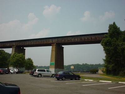
4. Today's Norfolk Southern Bridge
Taken from the parking lot looking north. The lip of the dam is visible behind and below the marker. Lake Accotink Road—with the yellow curbs—goes under the bridge and turns right.
Credits. This page was last revised on October 6, 2026. It was originally submitted on December 18, 2005, by J. J. Prats of Powell, Ohio. This page has been viewed 5,156 times since then and 121 times this year. Photos: 1. submitted on October 6, 2026, by Devry Becker Jones of Washington, District of Columbia. 2. submitted on December 18, 2005, by J. J. Prats of Powell, Ohio. 3. submitted on October 6, 2026, by Devry Becker Jones of Washington, District of Columbia. 4. submitted on December 18, 2005, by J. J. Prats of Powell, Ohio.
