Near Fredericksburg in Spotsylvania County, Virginia — The American South (Mid-Atlantic)
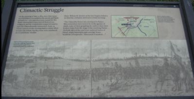
Climactic Struggle
Photographed by Craig Swain, November 10, 2007
1. Climactic Struggle Marker
Major William H. Stewart of the 61st Virginia Infantry recalled the confusion and horror of that morning:
"The Chancellor house was enveloped in flames .... Men everywhere were seen to be in the agonies of death, some of these grappling the earth to draw their broken forms from the range of the searching flames. On both sides of the road were scattered loaves of bread, empty haversacks and cartridge boxes... hundreds of knapsacks...thousands of muskets...."
Topics. This historical marker is listed in this topic list: War, US Civil. A significant historical date for this entry is May 3, 1868.
Location. 38° 18.546′ N, 77° 38.089′ W. Marker is near Fredericksburg, Virginia, in Spotsylvania County. It is at the intersection
this page online

Regionally, this marker is in the Washington Metropolitan Area, in Northern Virginia, and in the Piedmont. It is also in the American South, specifically in the Upper South, in the Mid-Atlantic, and on the Eastern Seaboard. Globally, it is in the North Atlantic Region, North America, the Western Hemisphere, the Western World, and the Anglosphere. Historically, it finds itself in what was once the territory of the Mississippian Culture, one of the original Thirteen Colonies, one of the Confederate States of America, and the Antebellum South.
Other nearby markers. At least 8 other markers are within walking distance of this marker: Lee's Greatest Triumph (here, next to this marker); The Chancellor Slaves (within shouting distance of this marker);
Photographed by Craig Swain, November 10, 2007
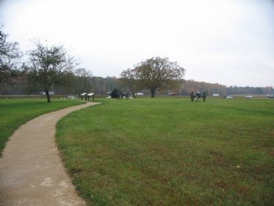
2. Driving Tour Stop Three at the Chancellorsville House Site
Other markers no longer nearby. Chancellorsville (was within shouting distance of this marker but has been permanently removed); Chancellorsville Home of Mrs. Sanford Chancellor (was within shouting distance of this marker but has been permanently removed); Battle of Chancellorsville (was within shouting distance of this marker but has been replaced with another marker now near it); a different marker also named Battle of Chancellorsville (was within shouting distance of this marker but has been permanently removed).
More about this marker. On the lower half of the marker is a drawing showing the artist impression of the fighting around the Chancellorsville
Photographed by Craig Swain, November 10, 2007
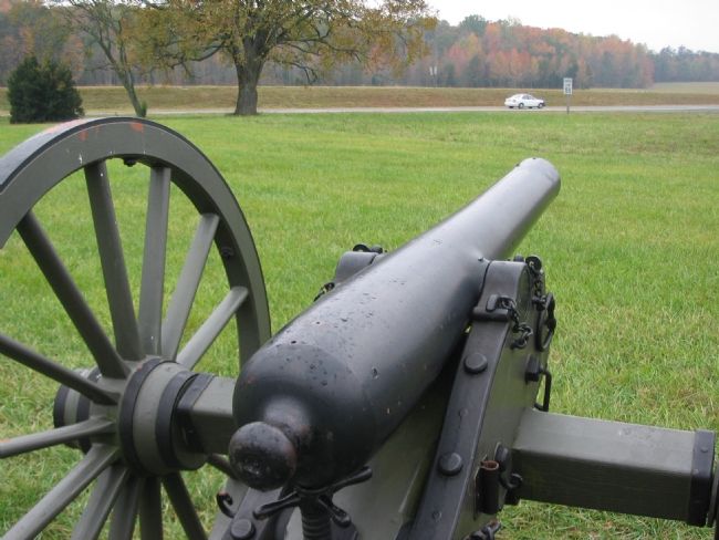
3. The Artillery Crew View of the Battlefield
Fairview lays in the distance to the background right in this view. In this frame, Stuart's and Anderson's converging Confederate lines advanced on the Federal positions near the location of the cannon. The Cannon pictured here is a 3in Ordnance Rifle, Model of 1861. Its registration number is 195, indicating a manufactured date of 1862. Similar weapons, if not this very piece, were deployed at the Chancellorsville intersection during the battle.
Regarding Climactic Struggle. This is one of several markers for the Battle of Chancellorsville at the Chancellorsville Intersection, scene of considerable fighting in the battle. See the Chancellorsville Intersection Virtual Tour by Markers in the links section for a listing of related markers on the tour.
Also see . . . Chancellorsville Intersection Virtual Tour by Markers. The Chancellorsville Intersection portion of the battlefield (stop three on the driving tour of the battlefield) includes markers at the intersection of the historic Plank and Ely's Ford Roads. Considerable fighting occurred here on May 3, 1863. (Submitted on December 8, 2007, by Craig Swain of Leesburg, Virginia.)
Credits. This page was last revised on January 22, 2026. It was originally submitted on November 29, 2007, by Craig Swain of Leesburg, Virginia. This page has been viewed 1,479 times since then and 29 times this year. Photos: 1, 2, 3. submitted on November 29, 2007, by Craig Swain of Leesburg, Virginia.
