Mount Pleasant in Charleston County, South Carolina — The American South (South Atlantic)
Wando Pottery
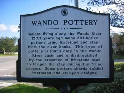
1. Wando Pottery Marker
Topics. This historical marker is listed in this topic list: Indigenous Peoples and Communities. A significant historical year for this entry is 1200.
Location. 32° 53.792′ N, 79° 49.154′ W. Marker is in Mount Pleasant, South Carolina, in Charleston County. It is at the intersection of State Highway 41 and Rivertown Blvd. on State Highway 41. Touch for map. Marker is in this post office area: Mount Pleasant SC 29466, United States of America. Touch for directions.

Regionally, this marker is in the Lowcountry. It is also in the American South, specifically in the Deep South, and on the Eastern Seaboard. Globally, it is in the North Atlantic Region, North America, the Western Hemisphere, the Western World, and the Anglosphere. Historically, it finds itself in what was once the
this page online
Other nearby markers. At least 8 other markers are within 4 miles of this marker, measured as the crow flies: Thomas Lynch at Rivertowne (approx. one mile away); Phillips Community (approx. 1.2 miles away); Point Plantation / Richmond Plantation (approx. 1.6 miles away); Brickyard Plantation (approx. 3 miles away); Keith School (approx. 3.1 miles away); Sweetgrass Baskets (approx. 3.1 miles away); Boone Hall Plantation (approx. 3½ miles away); Snee Farm Historic Structures (approx. 3½ miles away). Touch for a list and map of all markers in Mount Pleasant.
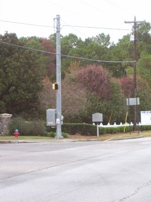
Photographed by Kiera Reinertsen, November 16, 2010
2. Wando Pottery Marker
Credits. This page was last revised on June 16, 2016. It was originally submitted on November 16, 2010. This page has been viewed 1,861 times since then and 68 times this year. Photos: 1, 2. submitted on November 16, 2010. • Bill Pfingsten was the editor who published this page.
