El Paso in El Paso County, Texas — The American South (West South Central)
Ysleta Plaza
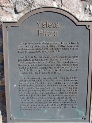
The present site of the Ysleta Neighborhood Health Clinic was part of the earliest Native American settlement associated with a Spanish Mission in the State of Texas, circa 1680 – 1750 A.D.
In 1989-1990, archaeologists conducted excavation and historic documentation prior to construction of the Ysleta Neighborhood Health Clinic. Research indicated that the original inhabitants of Ysleta migrated from Isleta Pueblo near Albuquerque to the Ysleta del Sur Pueblo in the early 1680s as a result of the Pueblo Revolt against the Spaniards in 1680.
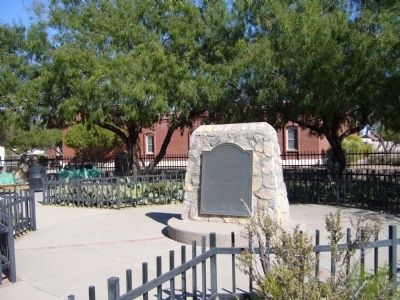
The excavations revealed many insights on the lifeways, architecture and subsistence of the Native American and Spanish settlers of the Post-Revolt Pueblo Period. For instance, the cactus and mesquite which surround this monument are examples of the type of food gathered by the Native American peoples to survive in our harsh desert climate. Remnants were found of a jacal structure, or a small one room house made of willow or cottonwood branches, lashed between posts and plastered with mud. These indications of how our ancestors lived show us the hardy nature of those who came to call Ysleta del Sur Pueblo home, and provide to us knowledge that future generations can use.
Spanish:
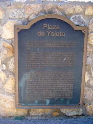
En 1989 - 1990, previo a la construccion de la Clinica de Salubridad en Ysleta, se condujeron investigaciones arqueologicas e historicas de ese local y de la region. La investigacion arqueologica indica que los habitantes originales de Ysleta emigraron del Pueblo de Isleta cerca de Albuquerque, Nuevo Mexico, al Pueblo de Ysleta del Sur debido a la Rebelion de los Pueblos contra los Españoles en 1680.
Las investigaciones revelaron muchas cosas a cerca de los estilos de vida, arquitectura y subsistencia de los colonos Indigenas y Españoles del Periodo Pos - Rebelion de los Pueblos. Por ejemplo, el cactus y el mesquite que estan alrededor de este monumento son ejemplos del tipo de alimentos que juntaban los Indigenas para sobrevivir en el duro clima del desierto. Fueron encontrados los restos de la estructura de un jacal, o una casa pequeña de un solo cuarto, las cuales eran construidas con ramas de alamo y ramas de sauce entrelazadas en los postes y cubiertas con barro. Estas indicaciones de como vivieron nuestros antepasados nos muestra la naturaleza fuerte y robusta de esos que vinieron a llamar el Pueblo de Ysleta del Sur su hogar, y nos proveen conocimientos que nuestras futuras generaciones podran usar.
Topics. This
historical marker is listed in these topic lists: Native Americans • Settlements & Settlers. A significant historical year for this entry is 1680.
Location. 31° 41.466′ N, 106° 19.538′ W. Marker is in El Paso, Texas, in El Paso County. Marker is on State Highway 20, 0.1 miles east of Old Pueblo Drive, on the left when traveling east. Touch for map. Marker is in this post office area: El Paso TX 79907, United States of America. Touch for directions.
Other nearby markers. At least 8 other markers are within 3 miles of this marker, measured as the crow flies. Alderete-Candelaria House (about 400 feet away, measured in a direct line); Oldest Mission in Texas (about 600 feet away); First Mission and Pueblo in Texas (about 600 feet away); San Antonio de Senecú (approx. 1.6 miles away); Captain Frank Jones (approx. 1.6 miles away); The Camino Real (approx. 2.6 miles away); Socorro (approx. 2.6 miles away); Socorro Mission La Purísima (approx. 2.6 miles away). Touch for a list and map of all markers in El Paso.
Credits. This page was last revised on June 16, 2016. It was originally submitted on November 17, 2010, by Bill Kirchner of Tucson, Arizona. This page has been viewed 857 times since then and 30 times this year. Photos: 1, 2, 3, 4. submitted on November 17, 2010, by Bill Kirchner of Tucson, Arizona. • Syd Whittle was the editor who published this page.


