
Woodland in Talbot County, Georgia — The American South (South Atlantic)
Double Bridges
<------<<<<
Photographed by David Seibert, October 30, 2010
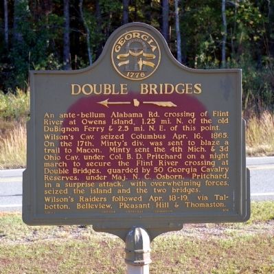
1. Double Bridges Marker
Wilson’s Cav. seized Columbus Apr. 16, 1865. On the 17th, Minty’s div. was sent to blaze a trail to Macon. Minty sent the 4th Mich. & 3d Ohio Cav. under Col. B. D. Pritchard on a night march to secure the Flint River crossing at Double Bridges, guarded by 50 Georgia Cavalry Reserves, under Maj. N.C. Osborn. Pritchard, in a surprise attack, with overwhelming forces, seized the island and the two bridges.
Wilson’s Raiders followed Apr. 18-19, via Talbotton, Belleview, Pleasant Hill & Thomaston.
Erected 1956 by Georgia Historical Commission. (Marker Number 130-2.)
Topics and series. This historical marker is listed in this topic list: War, US Civil. In addition, it is included in the Georgia Historical Society series list. A significant historical date for this entry is April 16, 1865.
Location. 32° 49.033′ N, 84° 28.883′ W. Marker is in Woodland, Georgia, in Talbot County. It is on Pleasant Hill Street (Georgia Route 36) 0 miles west of Double Bridges Road, on the right when traveling
this page online

Regionally, this marker is in Georgia’s Piedmont. It is also in the American South and specifically in the Deep South. Globally, it is in North America, the Western Hemisphere, the Western World, and the Anglosphere. Historically, it finds itself in what was once the territory of the Mississippian Culture, one of the original Thirteen Colonies, one of the Confederate States of America, and the Antebellum South.
Other nearby markers. At least 8 other markers are within 11 miles of this marker, measured as the crow flies: Old Belleview (approx. 5½ miles away); The Cove Gorges of the Flint (approx. 9.9 miles away); Pettigrew-White-Stamps House (approx. 9.9 miles away); First Baptist Church Bell Tower (approx. 10.2 miles away); William Carraway (approx. 10.2 miles away); Stephens Automobile Company (approx. 10.2 miles away); Timothy Bernard Seay, Jr. (approx. 10.2 miles away); Upson County Korean War Memorial (approx. 10.2 miles away).
Photographed by David Seibert, October 30, 2010
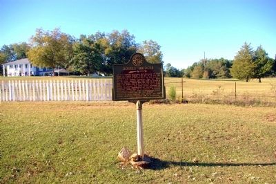
2. Double Bridges Marker
Pleasant Hill Manor is visible in the distance.
Photographed by David Seibert, October 30, 2010
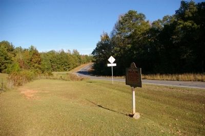
3. Double Bridges Marker
Looking east on GA Highway 36 toward the intersection with Double Bridges Road (visible in the distance) and the Flint River.
Photographed by David Seibert, October 30, 2010
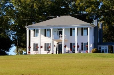
4. Pleasant Hill Manor
The home was built in 1834. Minty's Division and Wilson's Cavalry passed by the home on April 17-19, 1865.
Credits. This page was last revised on October 31, 2024. It was originally submitted on November 19, 2010, by David Seibert of Sandy Springs, Georgia. This page has been viewed 2,629 times since then and 106 times this year. Photos: 1, 2, 3, 4. submitted on November 19, 2010, by David Seibert of Sandy Springs, Georgia. • Craig Swain was the editor who published this page.
