Alexandria in Rapides Parish, Louisiana — The American South (West South Central)
Red River
Side A
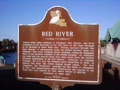
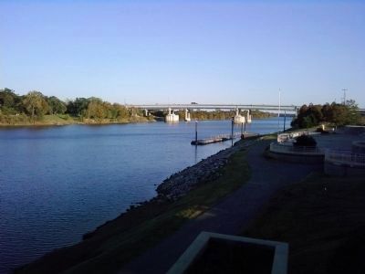
Twenty-seven miles southeast of Tucumcari, New Mexico, Red River originates in the watershed of the Frio Draw on the Llano Estacado at an elevation of about 5000 feet. Flowing eastward through Palo Duro Canyon, it subsequently forms the border between Texas and Oklahoma, then turns southeast across Louisiana joining the Mississippi River at the northern boundary of the Florida Parishes. Its distinctive red color and rich alluvial valley have been noted since the earliest European explorations in the 17th century. Following the Louisiana Purchase, the U.S. sent the Freeman-Curtis Expedition in 1806, to explore Red River and refute Spanish border claims. The first steamboat, the "Enterprise", ascended the Red River to Alexandria in 1814, but transportation above Natchitoches was blocked by the Great Raft until cleared by Capt. Henry Shreve in 1833-38. (Continued on other side)
Side B
(Continued from other side)
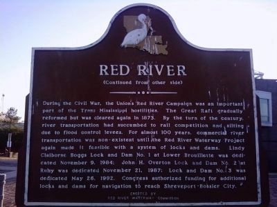
During the Civil War, the Union's Red River Campaign was an important part of the Trans-Mississippi hostilities. The Great Raft gradually reformed but was cleared again in 1873. By the turn of the century, river transportation had succumbed to rail competition and silting due to flood control levees. For almost 100 years, commercial river transportation was non-existent until the Red River Waterway Project again made it feasible with a system of locks and dams. Lindy Claiborne Boggs Lock and Dam No. 1 at Lower Brouillette was dedicated November 9, 1984; John H. Overton Lock and Dam No. 2 at Ruby was dedicated May 26, 1992. Congress authorized funding for additional locks and dams for navigation to reach Shreveport-Bossier City.
Erected by Red River Waterway Commission.
Topics. This historical marker is listed in these topic lists: Exploration • Industry & Commerce • Waterways & Vessels. A significant historical date for this entry is May 26, 1864.
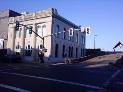
Location. 31° 18.745′ N, 92° 26.624′ W. Marker is in Alexandria, Louisiana, in Rapides Parish. Marker can be reached from Murray Street north of Main Street, on the left when traveling north. Marker is on the levee above the Old Rapides Bank Building/Alexandria Museum. Touch for map. Marker is in this post office area: Alexandria LA 71301, United States of America. Touch for directions.
Other nearby markers. At least 8 other markers are within walking distance of this marker. Old Rapides Bank Building (within shouting distance of this marker); Rapides Parish Governors (about 300 feet away, measured in a direct line); Pinckney Benton Stewart Pinchback (about 400 feet away); Louisiana Maneuvers (about 400 feet away); City Of Alexandria Post Des Rapides (about 400 feet away); The Rotary Club of Alexandria, Louisiana (about 400 feet away); Thomas Courtland Manning (about 500 feet away); Alexander Fulton Park (about 500 feet away). Touch for a list and map of all markers in Alexandria.
Credits. This page was last revised on October 29, 2020. It was originally submitted on November 23, 2010, by Lee Hattabaugh of Capshaw, Alabama. This page has been viewed 1,484 times since then and 23 times this year. Photos: 1, 2, 3, 4, 5, 6. submitted on November 23, 2010, by Lee Hattabaugh of Capshaw, Alabama. • Bill Pfingsten was the editor who published this page.
