Portland in Multnomah County, Oregon — The American West (Northwest)
The Willamette Stone

Photographed By Paul Crumlish, August 2, 2010
1. The Willamette Stone Marker
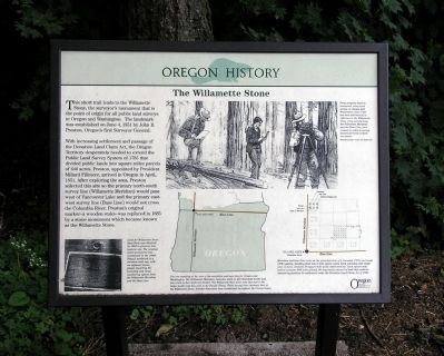
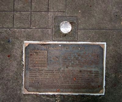
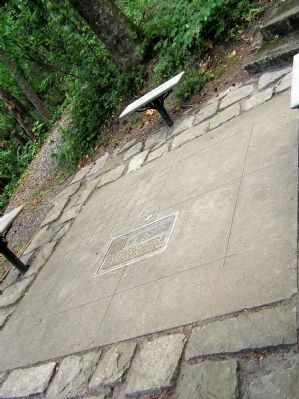
Captions: (bottom left) Land for Willamette Stone State Park was obtained in 1945 to preserve this historic site. The original stone was vandalized in the 1980s. Today's landmark is a stainless steel cap, with an adjacent bronze plaque depicting the township and range numbering system from the Willamette Meridian and the Base Line.; (bottom center) You are standing at the axis of the meridian and baseline for Oregon and Washington. The Willamette Meridian runs due north to the Canadian border and due south to the California border. The Willamette Base Line runs due east to the Idaho boarder and due west to the Pacific Ocean. These survey lines intersect here at the Willamette Stone. Similar lines have been established throughout the United States.; (top right) From property lines to easements, every land survey in Oregon and Washington since 1851 has been determined in reference to the Willamette Stone. Long survey lines, the Willamette Meridian and the Base Line, were created in order to survey distant portions of these two states.; (bottom right) Meridian and base lines serve as the principal axis of a township (N/S) and range (E/W) system, dividing land into 6 mile square units. Each township and range unit, in turn, contains 36 square mile units called sections. Each square mile section contains 640 acres of land, the maximum amount of land that could be claimed by families for settlement under the Donation Land Claim Act of 1850.
With increasing settlement and passage of the Donation Land Claim Act, the Oregon Territory desperately needed to extend the Public Land Survey System of 1785 that divided public lands into square miles parcels of 640 acres. Preston, appointed by President Millard Fillmore, arrived in Oregon in April, 1851. After exploring the area, Preston selected this site so the primary north-south survey line (Willamette Meridian) would pass west of Vancouver Lake and primary east-west survey line (Base Line) would not cross the Columbia River. Preston's original marker - a wooden stake - was replaced in 1885 by a stone monument which became known as the Willamette Stone.
Erected by Oregon Travel Information Council.
Topics and series. This historical marker is listed in this topic list: Settlements & Settlers. In addition, it is included in the Former U.S. Presidents: #13 Millard Fillmore, and the Oregon Beaver Boards series lists. A significant historical month for this entry is April 1851.
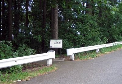
Location. 45° 31.274′ N, 122° 44.612′ W. Marker is in Portland, Oregon, in Multnomah County. Marker is on NW Skyline Boulevard, 0.4 miles west of West Burnside Road, on the left when traveling west. Touch for map. Marker is in this post office area: Portland OR 97210, United States of America. Touch for directions.
Other nearby markers. At least 8 other markers are within 8 miles of this marker, measured as the crow flies. A different marker also named The Willamette Stone (about 500 feet away, measured in a direct line); The Telegram Building, 1922 (approx. 3 miles away); The Salvation Army (approx. 3.2 miles away); Dekum Building (approx. 3.3 miles away); In Remembrance of the United States Battleship Oregon (approx. 3˝ miles away); The Medal of Honor (approx. 4.1 miles away); Vanport (approx. 6 miles away); Heart of a Trading Empire (approx. 7.7 miles away in Washington). Touch for a list and map of all markers in Portland.
Also see . . .
1. Willamette Stone, The - Oregon Travel Experience Audio Tour. (Submitted on November 25, 2010, by PaulwC3 of Northern, Virginia.)
2. The American Surveyor: Romancing the Stone at Willamette Meridan. (Submitted on November 25, 2010, by PaulwC3 of Northern, Virginia.)
3. Oregon Travel Experience - The Willamette Stone. (Submitted on January 12, 2018, by Douglass Halvorsen of Klamath Falls, Oregon.)
Credits. This page was last revised on February 11, 2018. It was originally submitted on November 25, 2010, by PaulwC3 of Northern, Virginia. This page has been viewed 1,940 times since then and 49 times this year. Photos: 1, 2, 3, 4. submitted on November 25, 2010, by PaulwC3 of Northern, Virginia.


