
Dover in Stewart County, Tennessee — The American South (East South Central)
Morrison's Brigade
McClernand's Division
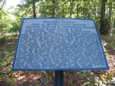
Photographed by Craig Swain, September 4, 2010
1. Morrison's Brigade Tablet
Brigadier General
John A. McClernand's Division
Colonel William R. Morrison's Brigade
49th Illinois, Lieut. Colonel Phineas Pease
On February 13, 1862, about 10 a.m., this brigade crossed Indian Creek Valley and took a position in the woods wst of here, within a quarter of a mile of these trenches. About noon, the brigade, with the 48th Illinois attached, received orders to attack Maney's Battery. Forming in line of battle under cover of the woods, the brigade advanced with the 49th Illinois on the right, the 48th Illinois on the left, and the 17th Illinois in the center. A company, deployed as skirmishers, preceded each regiment. The brigade ascended the steep hillside, the troops working their way laboriously through the almost impenetrable obstacle of the felled trees. Approaching to within 50 paces of this line of trenches, the brigade came under severe crossfire of the Confederate artillery and musketry. Although reinforced by the 45th Illinois, which came across the valley from Wynn's Ferry Road and formed on the right, all efforts to take the Confederate position failed. The
this page online
Topics. This historical marker is listed in this topic list: War, US Civil. A significant historical month for this entry is February 1862.
Location. 36° 28.731′ N, 87° 50.974′ W. Marker is in Dover, Tennessee, in Stewart County. It can be reached from Sandy Road, on the right when traveling north. Located at Maney's Battery, on a trail following the outer Confederate entrenchments, in Fort Donelson National Battlefield. Touch for map. Marker is in this post office area: Dover TN 37058, United States of America. Touch for directions.

Regionally, this marker is in Middle Tennessee and in the Highland Rim. It is also in the American South and specifically in the Upper South. Globally, it is in North America, the Western Hemisphere, the Western World, and the
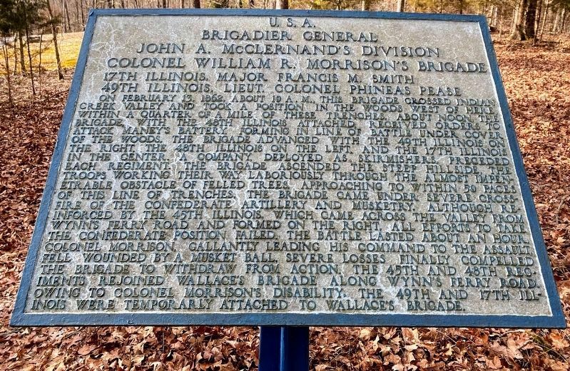
Photographed by Shane Oliver, February 7, 2021
2. Morrison's Brigade Marker
Other nearby markers. At least 8 other markers are within walking distance of this marker: Maney's Battery (a few steps from this marker); Heiman's Brigade (within shouting distance of this marker); Confederate Trenches (approx. 0.2 miles away); Wharton's Brigade (approx. ¼ mile away); French's Battery (approx. ¼ mile away); Forrest's Cavalry (approx. 0.3 miles away); Confederate Breakout (approx. 0.3 miles away); a different marker also named Confederate Breakout (approx. 0.3 miles away). Touch for a list and map of all markers in Dover.
Also see . . . Fort Donelson. National Park Service site. (Submitted on November 28, 2010, by Craig Swain of Leesburg, Virginia.)
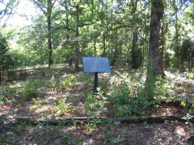
Photographed by Craig Swain, September 4, 2010
3. Morrison's Brigade Tablet
Just beyond the treeline is a modern housing subdivision, covering much of the area over which Morrison's brigade advanced during the battle.
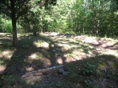
Photographed by Craig Swain, September 4, 2010
4. Confederate Trenches
The remains of the trenches which were the objective of Morrison's attack.
Credits. This page was last revised on May 10, 2021. It was originally submitted on November 28, 2010, by Craig Swain of Leesburg, Virginia. This page has been viewed 875 times since then and 20 times this year. Photos: 1. submitted on November 28, 2010, by Craig Swain of Leesburg, Virginia. 2. submitted on May 10, 2021, by Shane Oliver of Richmond, Virginia. 3, 4. submitted on November 28, 2010, by Craig Swain of Leesburg, Virginia.
