Near Catherine in Wilcox County, Alabama — The American South (East South Central)
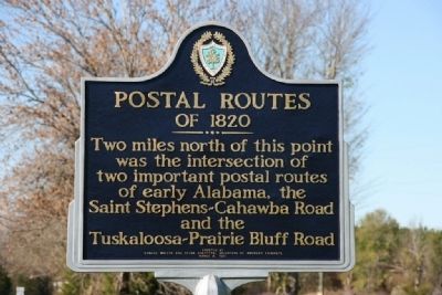
Postal Routes of 1820
Erected 1961 by Edward Waters and Selma Chapters, Daughters of American Colonists.
Topics and series. This historical marker is listed in these topic lists: Industry & Commerce • Roads & Vehicles. In addition, it is included in the Daughters of the American Colonists, and the Postal Mail and Philately series lists.
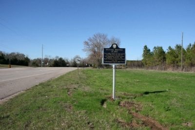
Location. 32° 7.116′ N, 87° 24.792′ W. Marker is near Catherine, Alabama, in Wilcox County. Marker is at the intersection of State Highway 28 and State Highway 162, on the right when traveling west on State Highway 28. Touch for map. Marker is in this post office area: Catherine AL 36728, United States of America. Touch for directions.
Other nearby markers. At least 8 other markers are within 11 miles of this marker, measured as the crow flies. Prairie Mission (approx. 2 miles away); The Founding of Gee's Bend / Boykin Mercantile Store in Gee's Bend (approx. 8.2 miles away); Bessie W. Munden Recreational Park (approx. 9˝ miles away); Confederate Dead of Wilcox County (approx. 11 miles away); Wilcox Female Institute (approx. 11.1 miles away); Camden (approx. 11.1 miles away); Lieutenant Joseph Morgan Wilcox (approx. 11.1 miles away); Camden Associate Reformed Presbyterian Church (approx. 11.1 miles away).
Credits. This page was last revised on June 16, 2016. It was originally submitted on November 28, 2010, by Timothy Carr of Birmingham, Alabama. This page has been viewed 957 times since then and 29 times this year. Photos: 1, 2. submitted on November 28, 2010, by Timothy Carr of Birmingham, Alabama. • Bill Pfingsten was the editor who published this page.

