Dover in Stewart County, Tennessee — The American South (East South Central)
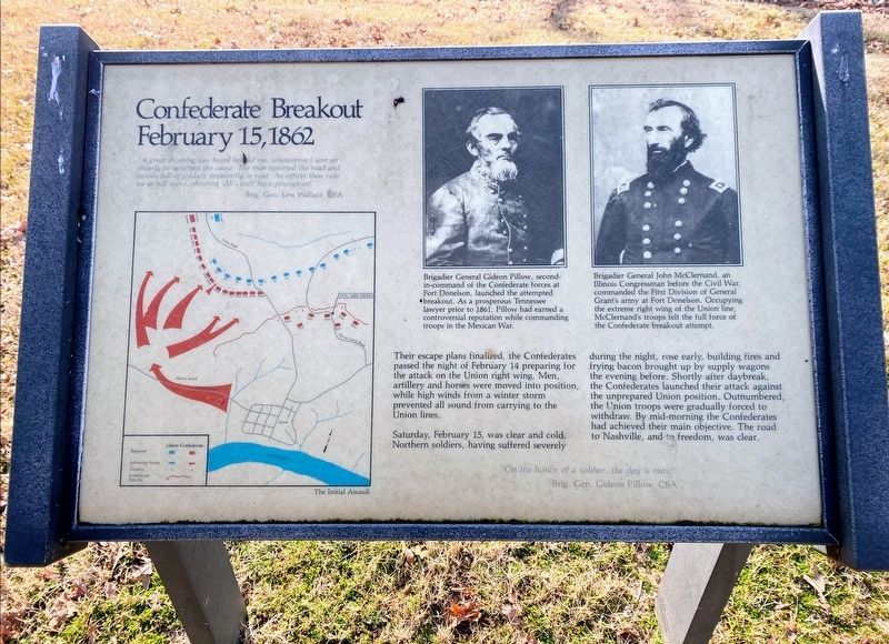
Confederate Breakout
February 15, 1862
"A great shouting was heard behind me, whereupon I sent an orderly to ascertain the cause. The man reported the road and woods full of soldiers apparently in rout. An officer then rode by at full speed, shouting 'All's lost! Save yourselves!'"
Brig. Gen. Lew Wallace, USA
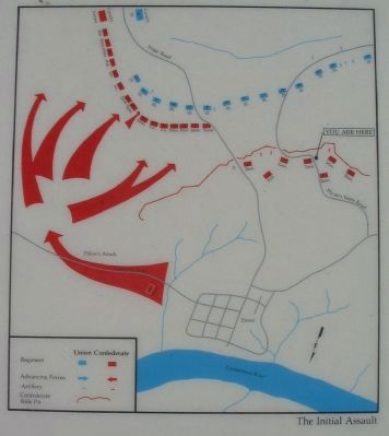
Their escape plans finalized, the Confederates passed the night of February 14 preparing for the attack on the Union right wing. Men, artillery and horses were moved into position, while high winds from a winter storm prevented all sound from carrying to the Union lines.
Saturday, February 15, was clear and cold. Northern soldiers, having suffered severely during the night, rose early, building fires and frying bacon brought up by supply wagons the evening before. Shortly after daybreak, the Confederates launched their attack against the unprepared Union position. Outnumbered, the Union troops were gradually forced to withdraw. By mid-morning the Confederates had achieved their main objective. The road to Nashville, and freedom, was clear.
"On the honor of a soldier, the day is ours!"
Brig. Gen. Gideon Pillow, CSA
Brigadier General Gideon Pillow, second-in-command of the Confederate forces at Fort Donelson, launched the attempted breakout. As a prosperous Tennessee lawyer prior to 1861, Pillow had earned a controversial reputation while commanding troops in the Mexican War.
Brigadier General John McClernand, an Illinois Congressman before the Civil War, commanded the First Division of General Grant's army at Fort Donelson. Occupying the extreme right wing of the Union line, McClernand's troops felt the full force of the Confederate breakout attempt.
Topics and series. This historical marker is listed in this topic list: War, US Civil. In addition, it is included in the Former U.S. Presidents: #18 Ulysses S. Grant series list. A significant historical date for this entry is February 14, 1862.
Location. 36° 28.808′ N, 87° 50.642′ W. Marker is in Dover, Tennessee, in Stewart County. Marker is on Cedar Street near Wynn's Ferry Loop, on the right when traveling east. Located on a footpath (actually formerly a park road) extending from Cedar Street at stop eight, French's Battery, on the driving tour of Fort Donelson National Battlefield. Touch for map. Marker is in this post office area: Dover TN 37058, United States of America. Touch for directions.
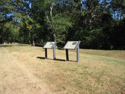
Other nearby markers. At least 8 other markers are within walking distance of this marker. A different marker also named Confederate Breakout (here, next to this marker); French's Battery (within shouting distance of this marker); Wharton's Brigade (about 400 feet away, measured in a direct line); Original Position (about 400 feet away); Baldwin's Brigade (about 600 feet away); Forrest's Cavalry (approx. 0.2 miles away); McCausland's Brigade (approx. ¼ mile away); Planning to Escape (approx. ¼ mile away). Touch for a list and map of all markers in Dover.
Also see . . . Fort Donelson. National Park Service site. (Submitted on November 30, 2010, by Craig Swain of Leesburg, Virginia.)
Credits. This page was last revised on May 10, 2021. It was originally submitted on November 30, 2010, by Craig Swain of Leesburg, Virginia. This page has been viewed 688 times since then and 16 times this year. Photos: 1. submitted on May 10, 2021, by Shane Oliver of Richmond, Virginia. 2, 3, 4. submitted on November 30, 2010, by Craig Swain of Leesburg, Virginia.


