Lewes Historic District in Sussex County, Delaware — The American Northeast (Mid-Atlantic)
The War of 1812
Lewes Maritime History Trail
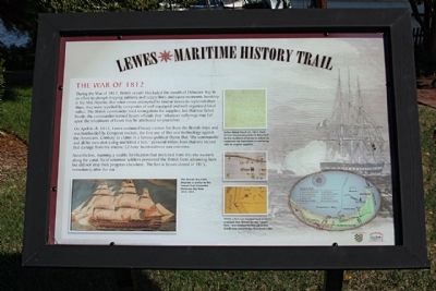
During the War of 1812, British vessels blockaded the mouth of Delaware Bay in an effort to disrupt shipping patterns and supply lines and cause economic hardship in the Mid-Atlantic. But when crews attempted to land at Lewes to replenish their ships, they were repelled by companies of well-organized local militia. The British commander tried to negotiate for supplies, but that too failed. Finally the commander warned Lewes officials that "whatever sufferings may fall upon the inhabitants of Lewes may be attributed to yourselves …"
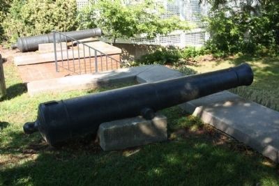
On April 6-8, 1813, Lewes sustained heavy cannon fire from the British ships and was bombarded by Congreve rockets, the first use of this new technology against the Americans. Contrary to claims in a famous political rhyme that "the commander and all his men shot a dog and a hen," personal letters from that era record that damage from the intense 22-hour bombardment was extensive.
Nevertheless, manning a sizable fortifcation that stretched from this site westerly along the canal, local volunteer soldiers prevented the British from advancing here but did not stop their progress elsewhere. The fort in Lewes closed in 1815, immediately after the war.
Erected by City of Lewes. (Marker Number 5.)
Topics. This historical marker is listed in these topic lists: Forts and Castles • War of 1812 • Waterways & Vessels. A significant historical month for this entry is April 1860.
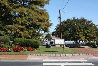
Location. 38° 46.55′ N, 75° 8.333′ W. Marker is in Lewes, Delaware, in Sussex County. It is in the Lewes Historic District. Marker is on Front Street, on the right when traveling north. Located between Neils Alley and Bank Street. Touch for map. Marker is in this post office area: Lewes DE 19958, United States of America. Touch for directions.
Other nearby markers. At least 8 other markers are within walking distance of this marker. The Bombardment of Lewes (here, next to this marker); a different marker also named The Bombardment of Lewes (here, next to this marker); Otis H. Smith City Dock (a few steps from this marker); The Cannonball House (within shouting distance of this marker); a different marker also named The Cannonball House (within shouting distance of this marker); The Explorations of Giovanni da Verrazzano (within shouting distance of this marker); Last Lewes Pilot Skiff (within shouting distance of this marker); Lewes-Rehoboth Canal (within shouting distance of this marker). Touch for a list and map of all markers in Lewes.
Also see . . . The War of 1812 , Wikipedia entry. The Americans declared war in 1812 for a number of reasons, including a desire for expansion into the Northwest Territory, trade restrictions because of Great Britain's ongoing war with France, impressment of American merchant sailors into the Royal Navy, British support of American Indian tribes against American expansion, and the humiliation of American honour.... Preoccupied in their pursuit of American privateers when the war began, the British naval forces had some difficulty in blockading the entire U.S. coast. The British government, having need of American foodstuffs for its army in Spain, benefited from the willingness of the New Englanders to trade with them, so no blockade of New England was at first attempted. The Delaware River and Chesapeake Bay were declared in a state of blockade on December 26, 1812. (Submitted on December 1, 2010, by Mike Stroud of Bluffton, South Carolina.)
Credits. This page was last revised on September 16, 2023. It was originally submitted on December 1, 2010, by Mike Stroud of Bluffton, South Carolina. This page has been viewed 1,259 times since then and 40 times this year. Photos: 1, 2, 3. submitted on December 1, 2010, by Mike Stroud of Bluffton, South Carolina.


