Downtown in Stamford in Fairfield County, Connecticut — The American Northeast (New England)
St. John's Episcopal Church
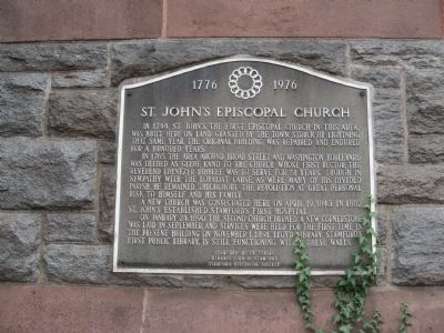
St. John's Episcopal Church
In 1765, the area around Broad Street and Washington Boulevard was deeded as glebe land to the church whose first rector, the Reverend Ebenezer Dibblee, was to serve for 51 years. Though in sympathy with the loyalist cause, as were many of his divided parish, he remained throughout the Revolution at personal risk to himself and his family.
A new church was consecrated here on April 19, 1843. In 1882 St. John's established Stamford's first hospital.
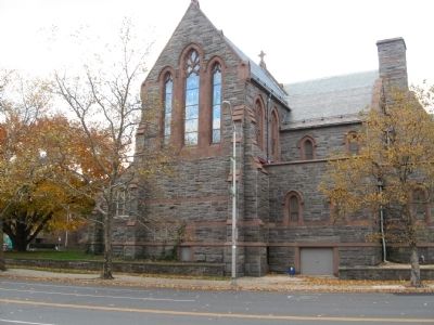
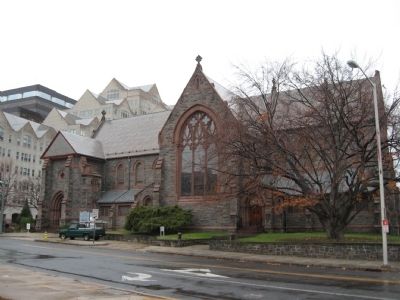
On January 24, 1890, the second church burned. A new cornerstone was laid in September, and services were held for the first time in the present building on November 1, 1891. Lloyd Library, Stamford's first public library, is still functioning within these walls.
Kiwanis Club of Stamford
Stamford Historical Society
Erected 1976 by the Kiwanis Club of Stamford and the Stamford Historical Society.
Topics. This historical marker is listed in these topic lists: Churches & Religion • Colonial Era. A significant historical month for this entry is January 1851.
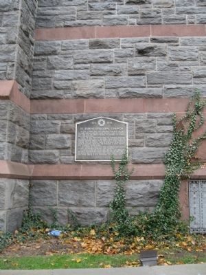
Location. 41° 3.256′ N, 73° 32.017′ W. Marker is in Stamford, Connecticut, in Fairfield County. It is in Downtown. Marker is at the intersection of Grove Street and Main Street, on the left when traveling north on Grove Street. Located on the east wall of St. John's Episcopal Church. Touch for map. Marker is at or near this postal address: 628 Main Street, Stamford CT 06901, United States of America. Touch for directions.
Other nearby markers. At least 8 other markers are within walking distance of this marker. Stamford Veterans Monument (about 300 feet away, measured in a direct line); Stamford World War I Memorial (about 400 feet away); Stamford Veterans Memorial (approx. 0.3 miles away); First Congregational Church (approx. 0.3 miles away); The Stamford Lincoln (approx. 0.3 miles away); Freedom Shrine (approx. 0.3 miles away); The Settlement of Stamford in 1641 (approx. 0.3 miles away); Stamford Old Town Hall (approx. 0.3 miles away). Touch for a list and map of all markers in Stamford.
Credits. This page was last revised on February 10, 2023. It was originally submitted on December 5, 2010, by Michael Herrick of Southbury, Connecticut. This page has been viewed 923 times since then and 16 times this year. Photos: 1, 2, 3, 4. submitted on December 5, 2010, by Michael Herrick of Southbury, Connecticut.


