Westown in Milwaukee in Milwaukee County, Wisconsin — The American Midwest (Great Lakes)
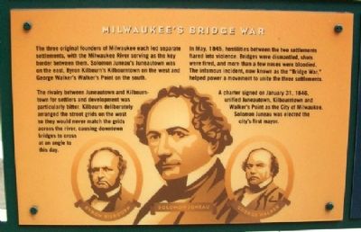
Milwaukee's Bridge War
The three original founders of Milwaukee each led separate settlements, with the Milwaukee River serving as the key border between them. Solomon Juneau's Juneautown was on the east, Byron Kilbourn's Kilbourntown on the west and George Walker's Walker's Point on the south.
The rivalry between Juneautown and Kilbountown for settlers and development was particularly bitter. Kilbourn deliberately arranged the street grids on the west so they would never match the grids across the river, causing downtown bridges to cross at an angle to this day.
In May, 1845, hostilities between the two settlements flared into violence. Bridges were dismantled, shots were fired, and more than a few noses were bloodied. The infamous incident, now known as the "Bridge War," helped power a movement to unite the three settlements.
A charter signed on January 31, 1846, unified Juneautown, Kilbourntown and Walker's Point as the City of Milwaukee. Solomon Juneau was elected the city's first mayor.
Erected by City of Milwaukee.
Topics. This historical marker is listed in these topic lists: Bridges & Viaducts • Government & Politics • Man-Made Features • Settlements & Settlers. A significant historical month for this entry is January 1727.
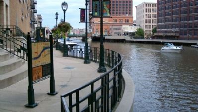
Location. 43° 2.342′ N, 87° 54.633′ W. Marker is in Milwaukee, Wisconsin, in Milwaukee County. It is in Westown. Marker is on the RiverWalk, about 50 feet north of the northwest corner of the Wisconsin Avenue Bridge over the Milwaukee River. Touch for map. Marker is in this post office area: Milwaukee WI 53202, United States of America. Touch for directions.
Other nearby markers. At least 8 other markers are within walking distance of this marker. Milwaukee's Miraculous Mallard (here, next to this marker); Gertie (within shouting distance of this marker); The First House on the East Side of Milwaukee (within shouting distance of this marker); Wisconsin's Oldest Newspaper (within shouting distance of this marker); Nearly a Century of Planning (about 300 feet away, measured in a direct line); Architectural Gems on the Riverfront (about 300 feet away); Every Building Tells a Story (about 300 feet away); The First Milwaukeeans (about 300 feet away). Touch for a list and map of all markers in Milwaukee.
Credits. This page was last revised on February 16, 2023. It was originally submitted on December 8, 2010, by William Fischer, Jr. of Scranton, Pennsylvania. This page has been viewed 1,720 times since then and 66 times this year. Photos: 1, 2. submitted on December 8, 2010, by William Fischer, Jr. of Scranton, Pennsylvania.

