Cusseta in Chattahoochee County, Georgia — The American South (South Atlantic)
Kasihta (Cusseta)
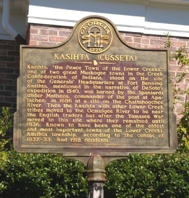
Kashita, “the Peace Town of the Lower Creeks,” one of two great Muskogee towns in the Creek Confederation of Indians, stood on the site of the Generals’ Headquarters at Fort Benning. Kashita, mentioned in the narrative of DeSoto’s expedition in 1540, was burned by the Spaniards under Matheos, commander of the post at Apalachee, in 1686 at a site on the Chattahoochee River. Then the Kashita with other Lower Creek tribes moved to the Ocmulgee River to be near the English traders but after the Yamasee War moved to this site where they remained until 1836. Known to have been one of the oldest and most important towns of the Lower Creeks, Kashita township, according to the census of 1832-33, had 1918 residents.
Erected 1956 by Georgia Historical Commission. (Marker Number 026-4.)
Topics and series. This historical marker is listed in these topic lists: Colonial Era • Native Americans. In addition, it is included in the Georgia Historical Society series list. A significant historical year for this entry is 1540.
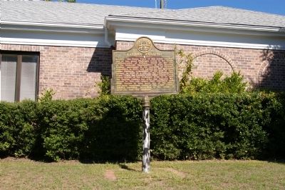
Location. 32° 18.376′ N, 84° 46.586′ W. Marker is in Cusseta, Georgia, in Chattahoochee County. Marker is on Broad Street (Georgia Route 520) 0 miles east of Lafayette Road, on the left when traveling east. The marker stands in front of the Chattahoochee County Courthouse. Touch for map. Marker is at or near this postal address: 377 Broad Street, Cusseta GA 31805, United States of America. Touch for directions.
Other nearby markers. At least 8 other markers are within 11 miles of this marker, measured as the crow flies. Chattahoochee County (a few steps from this marker); VFW Post 5000 (a few steps from this marker); Confederate Veterans (within shouting distance of this marker); Chattahoochee County Jail (within shouting distance of this marker); Cusseta School (approx. ¼ mile away); Louvale Church Row (approx. 9.4 miles away); Antioch Institute (approx. 9.4 miles away); Fryar Field (approx. 10½ miles away in Alabama). Touch for a list and map of all markers in Cusseta.
Credits. This page was last revised on May 3, 2020. It was originally submitted on December 8, 2010, by David Seibert of Sandy Springs, Georgia. This page has been viewed 916 times since then and 56 times this year. Photos: 1, 2, 3. submitted on December 8, 2010, by David Seibert of Sandy Springs, Georgia. • Bill Pfingsten was the editor who published this page.


