Manalapan Township in Monmouth County, New Jersey — The American Northeast (Mid-Atlantic)
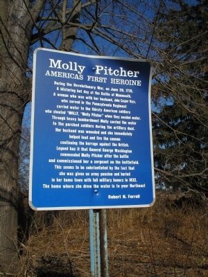
Molly Pitcher
Americas First Heroine
Photographed by Bill Coughlin, December 13, 2008
1. Molly Pitcher Marker
Robert N. Ferrell
Topics. This historical marker is listed in these topic lists: Notable Events • War, US Revolutionary. A significant historical month for this entry is June 1820.
Location. 40° 16.38′ N, 74° 18.875′ W. Marker is in Manalapan Township, New Jersey, in Monmouth County.
this page online

Regionally, this marker is in Central Jersey and in the New York City Metropolitan Area. It is also in the American Northeast, in the Mid-Atlantic, and on the Eastern Seaboard. Globally, it is in the North Atlantic Region, North America, the Western Hemisphere, the Western World, and the Anglosphere. Historically, it finds itself in what was once New Netherland and also one of the original Thirteen Colonies.
Other nearby markers. At least 8 other markers are within walking distance of this marker: Hold the Hedgerow! (approx. 0.3 miles away); The British Grenadiers (approx. 0.3 miles away); The British Rush the Hedgerow (approx. 0.3 miles away); Battle at the Parsonage (approx. half a mile away); Highlanders Decline Combat (approx. half a mile away); Perrine Hill Front Line (approx. half a mile away); The Great Cannonade (approx. half a mile away); An Inspiring Commander in Chief
Photographed by Bill Coughlin, December 13, 2008
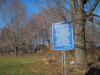
2. Marker on Freehold Englishtown Road
Molly Pitcher's name was actually Mary Hays. She survived her husband, remarried and lived until 1832.
Regarding Molly Pitcher. Mary Ludwig Hays, Wife of William Hays, Gunner in Francis Proctor's 4th Artillery. It is important to note that on June 28, 1778, Molly's name was Mary Ludwig Hays.
As I am the only member of the Sons of the American Revolution (SAR)with proven documentation that my great great great grandmother, Mary Ludwig Hays, never used the name McCauley until a decade after the Battle of Monmouth - Robert C. Goodyear
Also see . . .
1. Molly Pitcher: An American Heroine. (Submitted on December 13, 2008, by Bill Coughlin of Woodland Park, New Jersey.)
2. The Battle of Monmouth. New Jersey during the Revolution. (Submitted on December 13, 2008, by Bill Coughlin of Woodland Park, New Jersey.)

Photographed by Bill Coughlin, December 13, 2008
3. Molly Pitcher Marker
Marker is on the Freehold Englishtown Road, which bisects the Monmouth Battlefield.
Photographed by R. C.
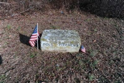
4. Molly Pitcher's Spring Marker
This stone marks a spot once considered a "possible" location where "Molly Pitcher" obtained water to quench the thirst of American cannoneers during the Battle of Monmouth. It is located near the intersection of Wemrock Road and Freehold-Englishtown Road (Coordinates: 40° 16.167′ N, 74° 18.267′ W).
Photographed by Bill Coughlin, July 7, 2008
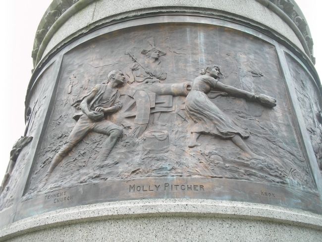
5. Molly Pitcher Plaque
The Battle of Monmouth Battle Monument in nearby Freehold, NJ contains a relief panel of Molly Pitcher assisting the cannon crew during the battle.
Photographed by Bill Coughlin, June 29, 2013
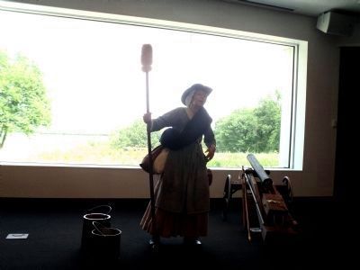
6. Molly Pitcher
Molly Pitcher at the Monmouth Battlefield for the 235th anniversary of the battle.
Photographed by Bill Coughlin, March 16, 2015
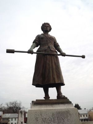
7. Molly Pitcher
This statue of Molly Pitcher is located at her grave in Carlisle, Pa.
Credits. This page was last revised on February 7, 2023. It was originally submitted on December 13, 2008, by Bill Coughlin of Woodland Park, New Jersey. This page has been viewed 3,625 times since then and 151 times this year. Last updated on December 9, 2010, by Robert C. Goodyear of Warminster, Pennsylvania. Photos: 1, 2, 3. submitted on December 13, 2008, by Bill Coughlin of Woodland Park, New Jersey. 4. submitted on January 5, 2009, by Ronald Claiborne of College Station, Texas. 5. submitted on December 13, 2008, by Bill Coughlin of Woodland Park, New Jersey. 6. submitted on June 29, 2013, by Bill Coughlin of Woodland Park, New Jersey. 7. submitted on March 16, 2015, by Bill Coughlin of Woodland Park, New Jersey. • Bill Pfingsten was the editor who published this page.
