East Dover Hundred in Kent County, Delaware — The American Northeast (Mid-Atlantic)
Thomas Stevenson House
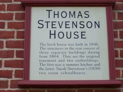
Photographed by Bill Pfingsten, December 15, 2010
1. Thomas Stevenson House Marker
Topics. This historical marker is listed in these topic lists: Architecture • Education • Women. A significant historical year for this entry is 1846.
Location. 39° 9.32′ N, 75° 31.407′ W. Marker is in Dover, Delaware, in Kent County. It is in East Dover Hundred. It is on S. State Street, on the right when traveling south. Touch for map. Marker is at or near this postal address: 420 South State Street, Dover DE 19901, United States of America. Touch for directions.

Regionally, this marker is in the American Mid-Atlantic, on the Delmarva Peninsula, and on the Eastern Seaboard. Globally, it is in the North Atlantic Region, North America, the Western Hemisphere, the Western World, and the Anglosphere. Historically, it finds itself in what was once New Netherland, one of the original Thirteen Colonies, and the Antebellum South.
Other nearby markers. At
this page online
Another marker is no longer nearby. John Bell House (was within shouting distance of this marker but has been replaced with another marker now near it).
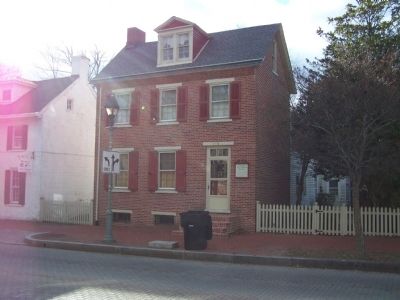
Photographed by Bill Pfingsten, December 15, 2010
2. Thomas Stevenson House
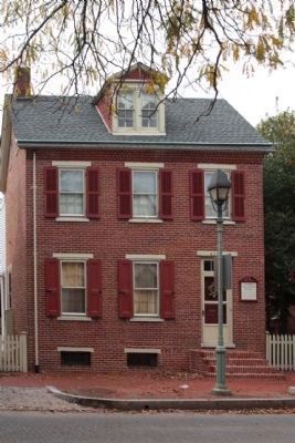
Photographed by Mike Stroud, October 17, 2012
3. Thomas Stevenson House and Marker
Credits. This page was last revised on July 25, 2026. It was originally submitted on December 18, 2010, by Bill Pfingsten of Bel Air, Maryland. This page has been viewed 2,131 times since then and 30 times this year. Photos: 1, 2. submitted on December 18, 2010, by Bill Pfingsten of Bel Air, Maryland. 3. submitted on November 3, 2012, by Mike Stroud of Bluffton, South Carolina.
