Near Spotsylvania Courthouse in Spotsylvania County, Virginia — The American South (Mid-Atlantic)
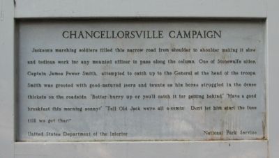
Chancellorsville Campaign
Erected by United States Department of the Interior - National Park Service.
Topics. This historical marker is listed in this topic list: War, US Civil.
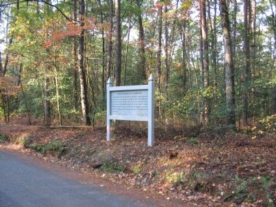
Location. 38° 16.175′ N, 77° 39.412′ W. Marker is near Spotsylvania Courthouse, Virginia, in Spotsylvania County. Marker is on Jackson Trail East, on the right when traveling south. Located on the Jackson Flank March driving loop in the Chancellorsville Battlefield section of the Fredericksburg and Spotsylvania National Battlefield Park. Touch for map. Marker is at or near this postal address: 11550 Jackson Trail E, Spotsylvania VA 22553, United States of America. Touch for directions.
Other nearby markers. At least 8 other markers are within 2 miles of this marker, measured as the crow flies. Ordeal of the Wellfords (approx. 0.9 miles away); Rearguard Action (approx. 0.9 miles away); a different marker also named Chancellorsville Campaign (approx. one mile away); a different marker also named Chancellorsville Campaign (approx. one mile away); a different marker also named Chancellorsville Campaign (approx. 1.2 miles away); a different marker also named Chancellorsville Campaign (approx. 1.4 miles away); A Region of Gloom (approx. 1.4 miles away); Catharine Furnace (approx. 1.4 miles away). Touch for a list and map of all markers in Spotsylvania Courthouse.
Regarding Chancellorsville Campaign. This is one of several markers for the Battle of Chancellorsville along the Jackson's Flank March and Attack trail. See the Jackson's Flank March and Attack Virtual Tour by Markers in the links section for a listing of related markers on the tour.

Photographed By Craig Swain, November 10, 2007
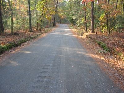
3. Flank Trail Near the Marker
The road has been widened since the war to accommodate two way motor vehicle traffic, but the passage is still somewhat cramped. Thus it is not hard to imagine the congestion of marching troops and the difficulty with passing around through the wooded areas beside the road.
Credits. This page was last revised on December 7, 2021. It was originally submitted on December 2, 2007, by Craig Swain of Leesburg, Virginia. This page has been viewed 1,128 times since then and 36 times this year. Photos: 1, 2, 3. submitted on December 2, 2007, by Craig Swain of Leesburg, Virginia.

